Haverhill Street Milestone

Why it's listed
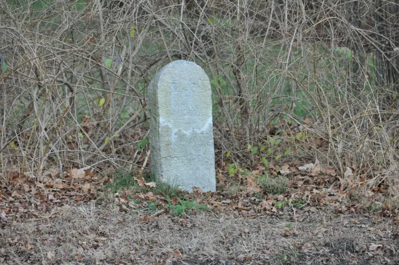
A weathered granite slab beside Haverhill Street in Reading, Massachusetts, this milestone stands between two house lots about 100 feet southeast of the Wakefield Street intersection. Roughly 2.5 to 3 feet tall with a rounded top, it dates to about 1800 and carries a painted inscription reading B 12 M, indicating twelve miles to Boston, possibly measured to the Boston stone. It was one of several markers that measured the old coach road between Boston and Haverhill, and similar stones survive in Wakefield beside Lake Quannapowitt and in Greenwood. The stone was taken out when Haverhill Street was widened and was put back at the request of local citizens. It is owned by the town. Its listing rests on its link to the era when Haverhill Street served as a principal coach route, and on the retention of its general location, setting, materials and workmanship. Vehicle exhaust and closeness to traffic are noted as risks.
Significance in brief: The marker recalls the period when Haverhill Street was a main north-south coach road linking Boston and Haverhill. It is one of several markers that measured the old coach road. The form says it keeps integrity of location, design, setting, materials, workmanship and feeling.
Machine-generated summary. This summary was generated by a language model from the official nomination document and has not been reviewed line by line by an editor. It may contain errors. Check the source document before relying on any detail. Source: nomination document (PDF) · National Archives catalog entry. NRHP reference 85000499, listed February 1, 1985. Summary generated October 2026 (model claude-sonnet-5-5, prompt v1.0-2026-10-29, confidence medium).
Key facts
| Address | Haverhill St., Reading |
|---|---|
| County | Middlesex County |
| Listed | February 1, 1985 |
| Reference number | 85000499 |
| Resource type | Object |
| Criteria |
|
| Areas of significance | Transportation |
| Level of significance | Local |
| Status (as stated in the nomination) | Listed as in good standing as a roadside marker; it was removed when Haverhill Street was widened and later replaced at citizens' request. Exhaust and nearness to the road are noted as threats. |
| Acreage | 0.2 |
| Coordinates | 42.54239, -71.08841 (NPS GIS) |
What listing means for this property
National Register listing is honorary: it recognises significance and does not restrict what a private owner may do without federal money or permits. It unlocks the 20% federal rehabilitation tax credit for income-producing buildings, state credits in many states, and Section 106 review when federal agencies are involved. See what listing means in practice.
General information, not legal or tax advice. Rules change; confirm with your State Historic Preservation Office or a qualified adviser.
Sources and further reading
- National Park Service, National Register of Historic Places database (snapshot May 2026), reference 85000499.
- Nomination form (PDF, National Archives) — catalog entry
- Wikipedia article (used for cross-checking only; text not reproduced here)
- Wikidata Q5683801
- This listing as JSON
Last updated October 2026. Found an error? See the editorial policy for how to report it.