Ashland Dam and Spillway

Why it's listed
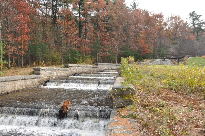
Built in 1885 in what is now Ashland State Park, this dam and spillway hold back the Ashland Reservoir across the valley of Cold Spring Brook. The dam is an earthen embankment 54 feet above the flooded meadow and 83 feet above bedrock, with a concrete core wall and a waterside covered in concrete paving and riprap. The 630-foot spillway is built of granite rubble masonry with heavy granite steps laid on concrete, and it carries overflow down to the brook. Its appearance is unusual: although manmade, it resembles a brook running through the woods. The structures were part of the Sudbury River supply and storage system begun in the 1870s, which supplied metropolitan Boston and was the second source tapped by the Metropolitan Water Board. They were recognized as good examples of late 19th-century water engineering, with the spillway standing out. The gatehouse was lost in 1976, and the reservoir later became a state park.
Significance in brief: The dam and spillway are tied to the Sudbury River supply, the second source tapped by the Metropolitan Water Board. They are good examples of late 19th-century water technology and design. The granite spillway is considered outstanding for its sculptural, almost natural look like a stream through the woods.
Machine-generated summary. This summary was generated by a language model from the official nomination document and has not been reviewed line by line by an editor. It may contain errors. Check the source document before relying on any detail. Source: nomination document (PDF) · National Archives catalog entry. NRHP reference 89002289, listed January 18, 1990. Summary generated October 2026 (model claude-sonnet-5-5, prompt v1.0-2026-10-29, confidence medium).
Key facts
| Address | N end of Ashland Reservoir in Ashland State Park, Ashland |
|---|---|
| County | Middlesex County |
| Listed | January 18, 1990 |
| Reference number | 89002289 |
| Resource type | Structure |
| Criteria |
|
| Areas of significance | Community Planning and Development, Engineering, Politics/Government |
| Level of significance | State, Local |
| Status (as stated in the nomination) | Condition is described as good. The gatehouse was demolished in 1976 due to vandalism, and the reservoir was turned over to the Commonwealth for use as a state park. |
| Acreage | 14 |
| Coordinates | 42.24607, -71.45952 (NPS GIS) |
What listing means for this property
For a publicly owned building or structure, listing mainly matters when federal funds, permits or licences are involved: projects then go through Section 106 review so effects on the property are considered. Listing also strengthens applications for preservation grants and, for leased income-producing uses, can enable the federal rehabilitation tax credit.
General information, not legal or tax advice. Rules change; confirm with your State Historic Preservation Office or a qualified adviser.
Sources and further reading
- National Park Service, National Register of Historic Places database (snapshot May 2026), reference 89002289.
- Nomination form (PDF, National Archives) — catalog entry
- Wikipedia article (used for cross-checking only; text not reproduced here)
- Wikidata Q4805243
- This listing as JSON
Last updated October 2026. Found an error? See the editorial policy for how to report it.