West Hatfield Historic District

Why it's listed
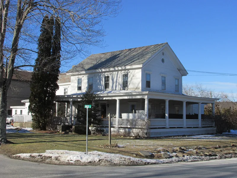
West Hatfield is a narrow strip of Connecticut River floodplain in Hatfield, Massachusetts, split north to south by Route 5-10 and bounded on the east by Interstate 91. The district contains 31 buildings, mainly modest farmhouses, cottages, tobacco sorting shops, barns and a chapel. The earliest house is a late-Federal dwelling of about 1830. Other buildings include an Italianate house of about 1845, a Stick Style Congregational Chapel of 1889 and several Queen Anne and Colonial Revival houses from the early twentieth century. Many were built by local farmer-carpenters, often from the German community. The area was listed for its agricultural past, especially tobacco and onion growing, and for its ethnic heritage. It is also listed for the way the automobile age brought tearooms, gas stations and other roadside businesses to West Street. The nomination also notes a strong chance of buried Native American and early farmstead remains.
Significance in brief: The district is significant for its associations with agriculture, ethnic heritage (European) and transportation. It shows how a thinly settled farming area of tobacco and onion growers, many of them German-descended, shifted toward roadside commercial use with the arrival of the automobile and Routes 5 and 10. It also has high archaeological potential.
Machine-generated summary. This summary was generated by a language model from the official nomination document and has not been reviewed line by line by an editor. It may contain errors. Check the source document before relying on any detail. Source: nomination document (PDF) · National Archives catalog entry. NRHP reference 05000079, listed February 24, 2005. Summary generated October 2026 (model claude-sonnet-5-5, prompt v1.0-2026-10-29, confidence medium).
Key facts
| Address | 3-12 Church Ave., 2 Linseed Rd., 23-42 West St., Hatfield |
|---|---|
| County | Hampshire County |
| Listed | February 24, 2005 |
| Reference number | 05000079 |
| Resource type | District |
| Period of significance | 1830-1959 |
| Architect / builder | Local farmer/builders including Frank L. Betsold and George Bitner; Eugene Strong built his own house at 12 Church Avenue |
| Architectural style | Federal, Greek Revival, Queen Anne, Colonial Revival, Stick Style, Italianate and vernacular farmhouses |
| Criteria |
|
| Areas of significance | Agriculture, European, Transportation |
| Level of significance | Local |
| Status (as stated in the nomination) | Most buildings are still in residential, religious and agricultural use; many have vinyl siding and replacement windows. A former box factory just outside the district is described as vacant. |
| Acreage | 30 |
| Coordinates | 42.37227, -72.63537 (NPS GIS) |
What listing means for this property
This is a historic district. Buildings within its boundary are either contributing (they add to the district's significance) or non-contributing. Owners of contributing income-producing buildings can claim the 20% federal rehabilitation tax credit; homeowners should look at state credits. National Register districts impose no design review by themselves; a local historic district ordinance, if one exists, does (the difference explained).
General information, not legal or tax advice. Rules change; confirm with your State Historic Preservation Office or a qualified adviser.
Sources and further reading
- National Park Service, National Register of Historic Places database (snapshot May 2026), reference 05000079.
- Nomination form (PDF, National Archives) — catalog entry
- Wikipedia article (used for cross-checking only; text not reproduced here)
- Wikidata Q7985321
- This listing as JSON
Last updated October 2026. Found an error? See the editorial policy for how to report it.