Mill-Prospect Street Historic District

Why it's listed
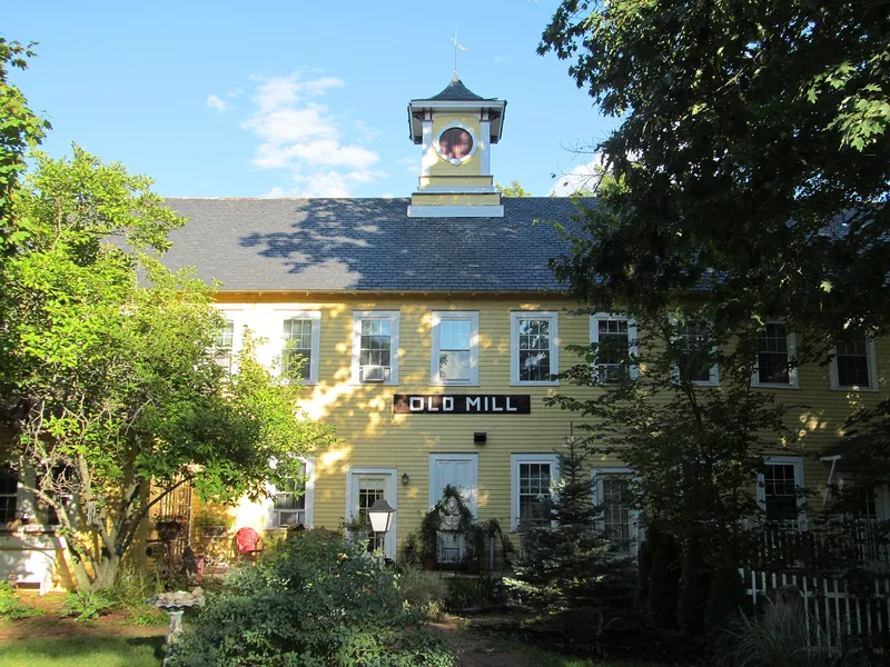
This district in Hatfield, Massachusetts, sits on the western edge of the Connecticut River floodplain, where the Mill River drops 16 feet over a natural falls. Prospect Street runs north to south through it, crossed by School, Bridge and Chestnut Streets. The district includes 169 contributing resources: houses, farmsteads, barns, mill buildings, structures and an object. Architectural styles range from Greek Revival through Italianate and Queen Anne to Colonial Revival, though many buildings are modest and have been resided. Water power supported a gristmill, a sawmill, the Shattuck gun shop and the Porter-McLeod lathe works. These industries drew central and eastern European immigrants, who also worked on local farms growing tobacco, onions and dairy products. Tobacco barns and livestock barns remain beside many houses. The district also contains the Borden Baseline, a copper bolt set in a boulder in 1830 as a survey point used to map Massachusetts and beyond.
Significance in brief: The district shows how a rural farming area along Prospect Street grew into a concentrated manufacturing and farming neighborhood powered by the Mill River. Firearms and machine-shop businesses, such as the Shattuck gun shop and Porter-McLeod lathe works, drew immigrant workers and shaped its housing. Its farmsteads, tobacco barns and the 1830 Borden Baseline survey marker add to its significance.
Machine-generated summary. This summary was generated by a language model from the official nomination document and has not been reviewed line by line by an editor. It may contain errors. Check the source document before relying on any detail. Source: nomination document (PDF) · National Archives catalog entry. NRHP reference 02001188, listed October 22, 2002. Summary generated October 2026 (model claude-sonnet-5-5, prompt v1.0-2026-10-29, confidence medium).
Key facts
| Address | Prospect, Chetnut, Bridge, School Sts., Raymond Ave., Prospect Court, Hatfield |
|---|---|
| County | Hampshire County |
| Listed | October 22, 2002 |
| Reference number | 02001188 |
| Resource type | District |
| Architectural style | Greek Revival, Italianate, Queen Anne, Colonial Revival |
| Areas of significance | Agriculture, Architecture, Industry, Art |
| Level of significance | Local |
| Status (as stated in the nomination) | Mix of residential, industrial and agricultural buildings in residential and commercial use; some houses altered with vinyl siding and replacement windows. |
| Acreage | 256.9 |
| Coordinates | 42.37569, -72.61335 (NPS GIS) |
What listing means for this property
This is a historic district. Buildings within its boundary are either contributing (they add to the district's significance) or non-contributing. Owners of contributing income-producing buildings can claim the 20% federal rehabilitation tax credit; homeowners should look at state credits. National Register districts impose no design review by themselves; a local historic district ordinance, if one exists, does (the difference explained).
General information, not legal or tax advice. Rules change; confirm with your State Historic Preservation Office or a qualified adviser.
Sources and further reading
- National Park Service, National Register of Historic Places database (snapshot May 2026), reference 02001188.
- Nomination form (PDF, National Archives) — catalog entry
- Wikipedia article (used for cross-checking only; text not reproduced here)
- Wikidata Q6858163
- This listing as JSON
Last updated October 2026. Found an error? See the editorial policy for how to report it.