Upper Main Street Historic District

Why it's listed
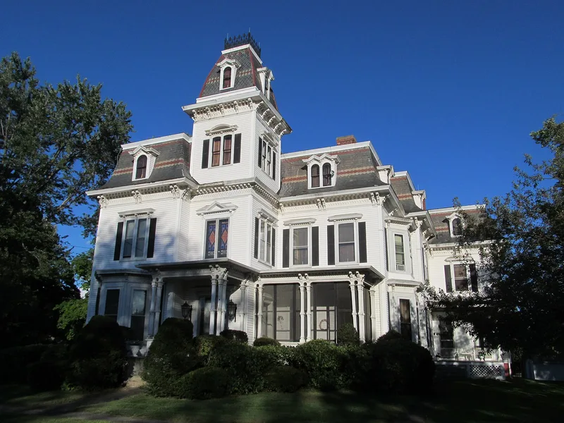
Upper Main Street runs north from the center of Hatfield, Massachusetts, and forms a district of farmhouses, barns and open fields that follows the town's original 17th-century layout. Settlers laid out narrow house lots along the street in 1661 and assigned meadow land to the north, and the northern meadows are still unfenced and farmed. Houses range from the Justin Waite House of about 1705 to modest Federal and Greek Revival farmhouses, several attributed to local carpenter Hiram Marsh, with a cluster of higher-style late 19th-century buildings near Main and North Streets. Tobacco, onions and potatoes were grown here, and livestock, horse and tobacco barns remain, though some early tobacco barns are vacant and deteriorating. The district was listed for its agricultural history, its architecture, and the way its settlement pattern has survived from 1705 through 1944, with 104 contributing resources.
Significance in brief: The district is significant for agriculture, architecture, community planning and development, and exploration/settlement. It preserves part of the original 1661 linear village plan, with house lots along the street and the northern meadows still farmed. Its buildings show Federal, Greek Revival and later styles in a consistent rural setting.
Machine-generated summary. This summary was generated by a language model from the official nomination document and has not been reviewed line by line by an editor. It may contain errors. Check the source document before relying on any detail. Source: nomination document (PDF) · National Archives catalog entry. NRHP reference 94000735, listed July 22, 1994. Summary generated October 2026 (model claude-sonnet-5-5, prompt v1.0-2026-10-29, confidence medium).
Key facts
| Address | Main St. from 83 Main to Cow Bridge, 1--44 King St. and 6--70 North St., Hatfield |
|---|---|
| County | Hampshire County |
| Listed | July 22, 1994 |
| Reference number | 94000735 |
| Resource type | District |
| Period of significance | 1705 - 1944 |
| Architect / builder | Hiram Marsh; Caleb Cooley Dickinson |
| Architectural style | Georgian, Federal, Greek Revival, Italianate, Second Empire, Queen Anne, Colonial Revival, Craftsman |
| Criteria |
|
| Areas of significance | Agriculture, Architecture, Community Planning and Development, Exploration/Settlement |
| Level of significance | Local |
| Status (as stated in the nomination) | Residential and agricultural use continues. Many early tobacco barns stand vacant and are deteriorating, while some tobacco shops and a barn have been converted to housing. |
| Acreage | 532 |
| Coordinates | 42.38782, -72.59533 (NPS GIS) |
What listing means for this property
This is a historic district. Buildings within its boundary are either contributing (they add to the district's significance) or non-contributing. Owners of contributing income-producing buildings can claim the 20% federal rehabilitation tax credit; homeowners should look at state credits. National Register districts impose no design review by themselves; a local historic district ordinance, if one exists, does (the difference explained).
General information, not legal or tax advice. Rules change; confirm with your State Historic Preservation Office or a qualified adviser.
Sources and further reading
- National Park Service, National Register of Historic Places database (snapshot May 2026), reference 94000735.
- Nomination form (PDF, National Archives) — catalog entry
- Wikipedia article (used for cross-checking only; text not reproduced here)
- Wikidata Q7898764
- This listing as JSON
Last updated October 2026. Found an error? See the editorial policy for how to report it.