Newburyport Historic District
Also known as: See Also:Essex County Superior Courthouse; Market Square Hist

Why it's listed
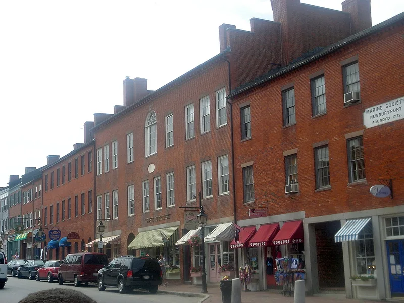
Newburyport's historic district covers about 750 acres at the mouth of the Merrimack River, roughly 40 miles north of Boston. Most of the city's residents live within it. It holds about 2,500 contributing structures built before 1930 and some 200 later ones, arranged as dense neighborhoods of wood-frame houses north and south of a commercial core of brick row buildings linked to maritime trade. The street grid, framed by High, Marlboro, Water, Merrimac and Ashland Streets, took shape in the seventeenth century and was largely complete by 1870. Architecture ranges from First Period farmhouses and waterfront dwellings of about 1650 to 1725, through high-style Georgian houses and brick mansions of the later eighteenth century, to Greek Revival, Italianate and Queen Anne buildings of the nineteenth century. Federal Period architecture predominates, including the large houses along the High Street ridge. The Fire of 1811 destroyed many early buildings near Market Square, but significant examples survive elsewhere in the district.
Significance in brief: The district preserves a densely built port city whose street grid dates to the seventeenth century. It contains good examples of architectural styles from the late 1600s to the early 1900s, with Federal Period buildings dominating, from modest cottages to high-style mansions along High Street. The surviving houses document successive building periods, from First Period farmsteads and waterfront dwellings to Georgian brick and timber houses.
Machine-generated summary. This summary was generated by a language model from the official nomination document and has not been reviewed line by line by an editor. It may contain errors. Check the source document before relying on any detail. Source: nomination document (PDF) · National Archives catalog entry. NRHP reference 84002411, listed August 2, 1984. Summary generated October 2026 (model claude-sonnet-5-5, prompt v1.0-2026-10-29, confidence medium).
Key facts
| Address | Roughly bounded by Merrimack River, Plummer Ave., Marlboro, Plummer, State, and High Sts., Newburyport |
|---|---|
| County | Essex County |
| Listed | August 2, 1984 |
| Reference number | 84002411 |
| Resource type | District |
| Architectural style | Federal Period dominant; also First Period, Georgian, timber-frame vernacular, Greek Revival, Italianate, Queen Anne and other styles from the late 17th to early 20th centuries |
| Areas of significance | Industry, Landscape Architecture, Commerce, Historic - Non-Aboriginal, Law, Politics/Government, Architecture, Religion |
| Level of significance | National, State, Local |
| Status (as stated in the nomination) | Listed as occupied; present uses include residential, commercial, educational, religious, museum, park, government and industrial. About 2,500 structures are contributing and 200 are non-contributing. |
| Acreage | 750 |
| Coordinates | 42.81713, -70.88391 (NPS GIS) |
What listing means for this property
This is a historic district. Buildings within its boundary are either contributing (they add to the district's significance) or non-contributing. Owners of contributing income-producing buildings can claim the 20% federal rehabilitation tax credit; homeowners should look at state credits. National Register districts impose no design review by themselves; a local historic district ordinance, if one exists, does (the difference explained).
General information, not legal or tax advice. Rules change; confirm with your State Historic Preservation Office or a qualified adviser.
Sources and further reading
- National Park Service, National Register of Historic Places database (snapshot May 2026), reference 84002411.
- Nomination form (PDF, National Archives) — catalog entry
- Wikipedia article (used for cross-checking only; text not reproduced here)
- Wikidata Q7017276
- This listing as JSON
Last updated October 2026. Found an error? See the editorial policy for how to report it.