Great Stone Dam
Also known as: Essex Company Dam

Why it's listed
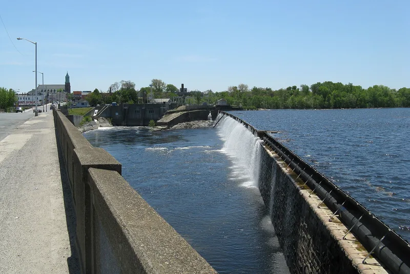
Spanning the Merrimack River at Lawrence, Massachusetts, this granite dam was built between 1845 and 1848 to hold back the river and raise the water level enough to power mills through two canals. It is 900 feet long in its overflow section, with wing walls bringing the total to 1,629 feet, and stands thirty to forty feet high. Charles S. Storrow, the Essex Company's treasurer and chief engineer, designed it, and Charles Bigelow oversaw construction. The dam is described as the first weir across a large American river to exceed ten feet in height. Its skewed, slightly curved form, ice-shedding crest, earthen embankment and tested hydraulic cement reflect early nineteenth-century practice. Engineers such as James Francis modeled later dams on it. It has withstood floods, including the 1936 freshet, without repair for about 130 years. Only a concrete fishway from 1918 and added crest dowels around 1914 changed it.
Significance in brief: The nomination calls it the first weir to cross a large American river with a height over ten feet. It embodies the weir design principles of the early nineteenth century and remained virtually unchanged from 1848. It also served as a model for later dam builders.
Machine-generated summary. This summary was generated by a language model from the official nomination document and has not been reviewed line by line by an editor. It may contain errors. Check the source document before relying on any detail. Source: nomination document (PDF) · National Archives catalog entry. NRHP reference 77000184, listed April 13, 1977. Summary generated October 2026 (model claude-sonnet-5-5, prompt v1.0-2026-10-29, confidence high).
Key facts
| Address | Merrimack River & MA 28, Lawrence |
|---|---|
| County | Essex County |
| Listed | April 13, 1977 |
| Reference number | 77000184 |
| Resource type | Structure |
| Period of significance | 1845-48 |
| Architect / builder | Charles S. Storrow (designer); Charles Bigelow, Construction Engineer of the Essex Company |
| Areas of significance | Engineering |
| Level of significance | State |
| Status (as stated in the nomination) | Dam remains in place with its original form largely unaltered; a concrete fishway added in 1918 is still in use and crest stones were reinforced around 1914. |
| Acreage | 2 |
| Coordinates | 42.70097, -71.16612 (NPS GIS) |
What listing means for this property
For a publicly owned building or structure, listing mainly matters when federal funds, permits or licences are involved: projects then go through Section 106 review so effects on the property are considered. Listing also strengthens applications for preservation grants and, for leased income-producing uses, can enable the federal rehabilitation tax credit.
General information, not legal or tax advice. Rules change; confirm with your State Historic Preservation Office or a qualified adviser.
Sources and further reading
- National Park Service, National Register of Historic Places database (snapshot May 2026), reference 77000184.
- Nomination form (PDF, National Archives) — catalog entry
- Wikipedia article (used for cross-checking only; text not reproduced here)
- Wikidata Q5600041
- This listing as JSON
Last updated October 2026. Found an error? See the editorial policy for how to report it.