Eastern Point Light Station

Why it's listed
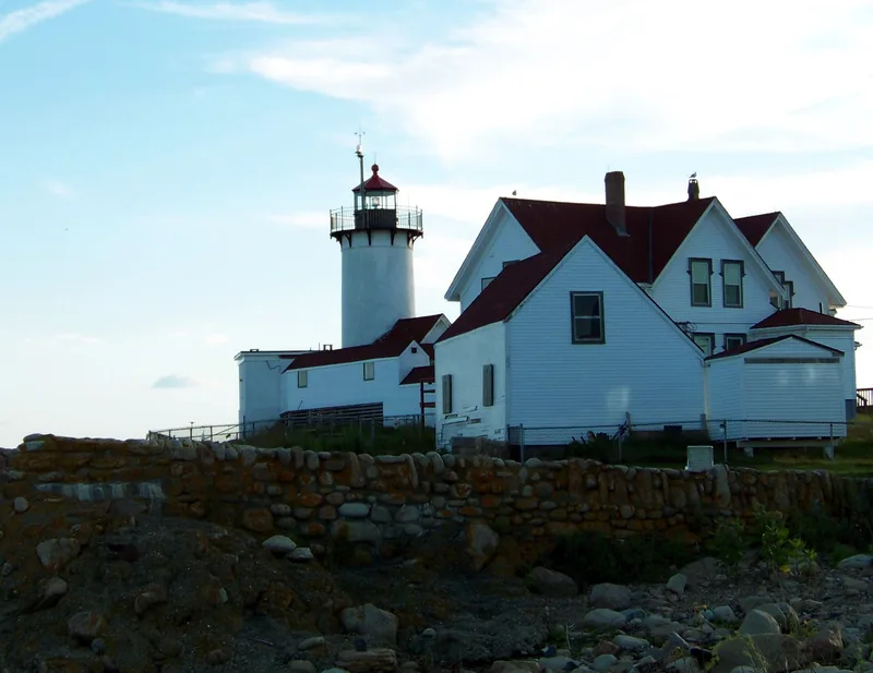
Eastern Point Light Station occupies a rocky promontory overlooking Dog Bar Reef at the eastern entrance to Gloucester Harbor. The one-acre site holds a complete set of buildings: a 38-foot cylindrical brick tower rebuilt in 1890 on its 1832 masonry foundation, a Gothic Revival double keeper's dwelling from 1879, a Shingle Style assistant keeper's house from 1908, an oil house, a long covered walkway ending in a brick building painted as a red and white daymark, and later fog signal and radio beacon equipment. The grounds are described as well integrated and massed. The station was listed as the largest intact light station in Massachusetts, retaining its period tower, dwelling, walkway, oil house and bell tower. It also has a link to the painter Winslow Homer, who lived in the lighthouse in 1880, during the years his scenes of the local maritime community became among his best known. Automated in 1986, it remains active.
Significance in brief: The nomination argues the station keeps integrity of location, design, setting, materials and workmanship and is tied to the development of aids to navigation in Massachusetts. It is described as the largest intact station in the state, preserving a period tower, keeper's house, walkway, oil house and bell tower. Painter Winslow Homer lived in the lighthouse in 1880.
Machine-generated summary. This summary was generated by a language model from the official nomination document and has not been reviewed line by line by an editor. It may contain errors. Check the source document before relying on any detail. Source: nomination document (PDF) · National Archives catalog entry. NRHP reference 87002027, listed September 30, 1987. Summary generated October 2026 (model claude-sonnet-5-5, prompt v1.0-2026-10-29, confidence medium).
Key facts
| Address | Eastern Pt., Gloucester |
|---|---|
| County | Essex County |
| Listed | September 30, 1987 |
| Reference number | 87002027 |
| Resource type | District |
| Architectural style | Gothic Revival/Queen Anne double keeper's dwelling (1879); Shingle Style secondary keeper's dwelling (1908) |
| Criteria |
|
| Areas of significance | Engineering, Transportation, Architecture, Maritime History |
| Level of significance | State |
| Status (as stated in the nomination) | Active aid to navigation, automated and unmanned since 1986; the dwelling is used for Coast Guard housing. Owned by the First Coast Guard District. |
| Acreage | 1 |
| Coordinates | 42.57735, -70.66396 (NPS GIS) |
What listing means for this property
This is a historic district. Buildings within its boundary are either contributing (they add to the district's significance) or non-contributing. Owners of contributing income-producing buildings can claim the 20% federal rehabilitation tax credit; homeowners should look at state credits. National Register districts impose no design review by themselves; a local historic district ordinance, if one exists, does (the difference explained).
General information, not legal or tax advice. Rules change; confirm with your State Historic Preservation Office or a qualified adviser.
Sources and further reading
- National Park Service, National Register of Historic Places database (snapshot May 2026), reference 87002027.
- Nomination form (PDF, National Archives) — catalog entry
- Wikipedia article (used for cross-checking only; text not reproduced here)
- Wikidata Q5330382
- This listing as JSON
Last updated October 2026. Found an error? See the editorial policy for how to report it.