King Airfield Hangar

Why it's listed
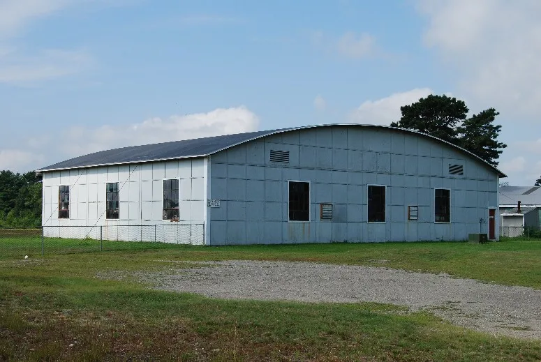
Built in 1919 on Middleboro Avenue in East Taunton, this wood and corrugated iron hangar measures roughly 80 by 80 feet. Henry King, a dairy farmer, converted his 50-acre farm into an airfield that year after buying a surplus WWI Curtiss Jenny trainer, and the plane was kept in this building. The Kings started a flying school and offered lessons and sightseeing flights over the Taunton area. In the 1940s and 1950s they ran an air taxi service between eastern seaboard cities, and local industries hangared their own planes there to move goods and materials. A federal airport aid grant in 1959 paid for a paved runway, taxi strips and lighting, and the field became Taunton Municipal Airport. The old hangar sits on a small undeveloped part of the original farm. It is regarded as the earliest standing piece of one of New England's first private airports and is described as vacant, in fair condition, with a past use as storage.
Significance in brief: It is the earliest standing remnant of King's Field, one of New England's first private airports and reputedly the earliest operating commercial airfield in Massachusetts. The hangar housed King's surplus WWI Curtiss Jenny trainer and is an important landmark in the state's aviation history. It retains integrity of location, design, setting, materials, workmanship and association.
Machine-generated summary. This summary was generated by a language model from the official nomination document and has not been reviewed line by line by an editor. It may contain errors. Check the source document before relying on any detail. Source: nomination document (PDF) · National Archives catalog entry. NRHP reference 84002141, listed July 5, 1984. Summary generated October 2026 (model claude-sonnet-5-5, prompt v1.0-2026-10-29, confidence medium).
Key facts
| Address | Middleboro Ave., Taunton |
|---|---|
| County | Bristol County |
| Listed | July 5, 1984 |
| Reference number | 84002141 |
| Resource type | Structure |
| Criteria |
|
| Areas of significance | Transportation |
| Level of significance | Local |
| Status (as stated in the nomination) | Listed as vacant, in fair condition; later used for storage. |
| Acreage | 0.9 |
| Coordinates | 41.88088, -71.01995 (NPS GIS) |
What listing means for this property
National Register listing is honorary: it recognises significance and does not restrict what a private owner may do without federal money or permits. It unlocks the 20% federal rehabilitation tax credit for income-producing buildings, state credits in many states, and Section 106 review when federal agencies are involved. See what listing means in practice.
Noted as vacant in the nomination. Nomination documents can be decades old; current status may differ. If you are considering buying an empty listed property, read the due-diligence checklist.
General information, not legal or tax advice. Rules change; confirm with your State Historic Preservation Office or a qualified adviser.
Sources and further reading
- National Park Service, National Register of Historic Places database (snapshot May 2026), reference 84002141.
- Nomination form (PDF, National Archives) — catalog entry
- Wikipedia article (used for cross-checking only; text not reproduced here)
- Wikidata Q6411219
- This listing as JSON
Last updated October 2026. Found an error? See the editorial policy for how to report it.