Bay Road
Also known as: Post Road; Road from Taunton to Boston

Why it's listed
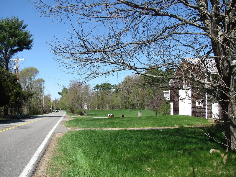
This two-mile section of Bay Road in Easton, Massachusetts, is the best-preserved part of an old route that ran from Boston to Taunton. The road began as an Indian path, later known as the Post Road and the King's Highway, and it served early inland settlers who needed to reach mills on the Neponset River and the town of Boston. While most of the thirty-six mile road has been greatly altered, this stretch has kept its direction and character for more than 250 years. Maps and deeds, some dating to 1717, place it where it runs today. Along it are colonial buildings such as the Keith House, the Benjamin Williams Tavern and the Thomas Manley House, plus nineteenth-century and later homes, two milestones dated 1773, and the John Williams Cemetery with stones from 1739. Stone walls, trees and open land give the road a rural, continuous appearance.
Significance in brief: The nomination argues the district's importance lies in its historical continuity: this section has not changed in direction or physical character in over 250 years, while most of the thirty-six mile road has been greatly altered. Maps and deeds from as early as 1717 show it in its present location as a main route to Boston. It also preserves colonial houses, taverns, milestones and a cemetery.
Machine-generated summary. This summary was generated by a language model from the official nomination document and has not been reviewed line by line by an editor. It may contain errors. Check the source document before relying on any detail. Source: nomination document (PDF) · National Archives catalog entry. NRHP reference 72000118, listed May 5, 1972. Summary generated October 2026 (model claude-sonnet-5-5, prompt v1.0-2026-10-29, confidence medium).
Key facts
| Address | 416-535 Bay Rd. (Foundry St. to the Norton town line), Easton |
|---|---|
| County | Bristol County |
| Listed | May 5, 1972 |
| Reference number | 72000118 |
| Resource type | District |
| Architectural style | Colonial, with some Federal, Greek Revival, nineteenth-century and contemporary dwellings |
| Areas of significance | Engineering, Transportation |
| Level of significance | State, Local |
| Status (as stated in the nomination) | Condition is marked good. The road is now a secondary road used mostly by local traffic, lined with dwellings, sheds and barns and no commercial structures. |
| Acreage | 130 |
| Coordinates | 42.01056, -71.12031 (NPS GIS) |
What listing means for this property
This is a historic district. Buildings within its boundary are either contributing (they add to the district's significance) or non-contributing. Owners of contributing income-producing buildings can claim the 20% federal rehabilitation tax credit; homeowners should look at state credits. National Register districts impose no design review by themselves; a local historic district ordinance, if one exists, does (the difference explained).
General information, not legal or tax advice. Rules change; confirm with your State Historic Preservation Office or a qualified adviser.
Sources and further reading
- National Park Service, National Register of Historic Places database (snapshot May 2026), reference 72000118.
- Nomination form (PDF, National Archives) — catalog entry
- Wikipedia article (used for cross-checking only; text not reproduced here)
- Wikidata Q4874079
- This listing as JSON
Last updated October 2026. Found an error? See the editorial policy for how to report it.