Angle Tree Stone

Why it's listed
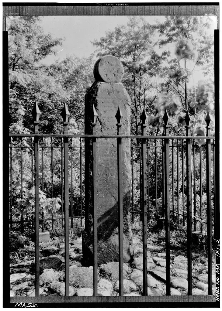
Deep in a wooded clearing among farm fields, a slate shaft fourteen feet high, two feet wide and four inches thick marks a turning point in colonial Massachusetts. Erected in 1790 on the order of the General Court, it replaced a tree that surveyors marked in 1664 to show where the boundary between the Massachusetts Bay and Plymouth colonies changed direction, from southwest to due west toward Rhode Island. The line lies three miles south of the southern end of the Charles River and now divides Norfolk County from Plymouth and Bristol Counties. This is the only angle along the whole line. A carved circle tops the stone, with Massachusetts Colony inscribed on the north side and Plymouth Colony on the south. A long inscription names the 1664 commissioners and the officials present. Weathering, spalling and graffiti have damaged the slate, and an iron railing was added for protection. A small park with interpretive displays was proposed.
Significance in brief: It marks the spot where a tree identified the only angle and change of direction in the 1664 boundary between the Massachusetts Bay and Plymouth colonies. The nomination also argues it has gained significance as a monument through its age. Its 1790 inscription records the commissioners who surveyed the line.
Machine-generated summary. This summary was generated by a language model from the official nomination document and has not been reviewed line by line by an editor. It may contain errors. Check the source document before relying on any detail. Source: nomination document (PDF) · National Archives catalog entry. NRHP reference 76000228, listed January 1, 1976. Summary generated October 2026 (model claude-sonnet-5-5, prompt v1.0-2026-10-29, confidence high).
Key facts
| Address | W of North Attleborough off High St., North Attleborough |
|---|---|
| County | Bristol County |
| Listed | January 1, 1976 |
| Reference number | 76000228 |
| Resource type | Object |
| Period of significance | 1790 |
| Areas of significance | Exploration/Settlement |
| Level of significance | State |
| Status (as stated in the nomination) | Described as deteriorating from weathering and vandalism, with spalling slate and graffiti; an iron railing surrounds it, and a small interpretive park was proposed. |
| Acreage | 0.3 |
| Coordinates | 41.98526, -71.36437 (NPS GIS) |
What listing means for this property
National Register listing is honorary: it recognises significance and does not restrict what a private owner may do without federal money or permits. It unlocks the 20% federal rehabilitation tax credit for income-producing buildings, state credits in many states, and Section 106 review when federal agencies are involved. See what listing means in practice.
General information, not legal or tax advice. Rules change; confirm with your State Historic Preservation Office or a qualified adviser.
Sources and further reading
- National Park Service, National Register of Historic Places database (snapshot May 2026), reference 76000228.
- Nomination form (PDF, National Archives) — catalog entry
- Wikipedia article (used for cross-checking only; text not reproduced here)
- Wikidata Q4763353
- This listing as JSON
Last updated October 2026. Found an error? See the editorial policy for how to report it.