West Falmouth Village Historic District
Also known as: See Also:Bourne Farm

Why it's listed
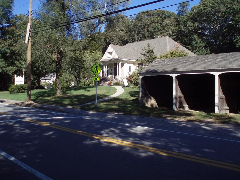
West Falmouth Village is a historic district on the Buzzards Bay coast of Falmouth, Massachusetts, stretching along nearly three miles of the West Falmouth Highway, which was laid out in 1753. A wooded glacial moraine lies to the east and tidal marsh and harbor to the west. The district holds 321 resources, including houses from the 18th through 20th centuries, a blacksmith shop dating to 1778, two Quaker cemeteries, the marked sites of the 1720 Quaker meeting house and the earlier burial ground, and a surviving fragment of the 17th century road, Friends Way. Bourne Farm, individually listed earlier, anchors the north end, and Great Sippewissett Marsh defines the south. The village grew from farming, salt hay harvesting, shellfishing and small industries such as a windmill grist mill that operated from 1787 to 1922. Families such as the Giffords, Weeks, Bowermans and Dillinghams shaped its development. The nomination values the district for its intact settlement pattern and varied architecture.
Significance in brief: The nomination presents the district as an exceptionally complete and well-preserved example of a Cape Cod village that developed over three centuries. Its linear settlement pattern, shaped by the glacial moraine and coast, survives, along with dwellings of prominent families, Quaker sites, and farm and marsh landscapes. Together they show the area's agricultural, maritime and later summer resort history.
Machine-generated summary. This summary was generated by a language model from the official nomination document and has not been reviewed line by line by an editor. It may contain errors. Check the source document before relying on any detail. Source: nomination document (PDF) · National Archives catalog entry. NRHP reference 98000253, listed April 2, 1998. Summary generated October 2026 (model claude-sonnet-5-5, prompt v1.0-2026-10-29, confidence medium).
Key facts
| Address | Roughly along N. Shore Rd., from jct. of MA 28a and MA 28, and Crocker Point, Falmouth |
|---|---|
| County | Barnstable County |
| Listed | April 2, 1998 |
| Reference number | 98000253 |
| Resource type | District |
| Architectural style | Georgian, Federal, Greek Revival, Gothic Revival, Italianate, Second Empire, Queen Anne, Shingle Style, Stick Style, Colonial Revival, Classical Revival, Bungalow/Craftsman, and others |
| Areas of significance | Exploration/Settlement, Religion, Maritime History, Architecture, Agriculture |
| Level of significance | Local |
| Status (as stated in the nomination) | Most buildings remain in use as dwellings, churches, a library, a fire station and stores. Former farmland has partly reverted to woodland or been subdivided, and the former mill and other resources are gone or altered. |
| Acreage | 423 |
| Coordinates | 41.60081, -70.63535 (NPS GIS) |
What listing means for this property
This is a historic district. Buildings within its boundary are either contributing (they add to the district's significance) or non-contributing. Owners of contributing income-producing buildings can claim the 20% federal rehabilitation tax credit; homeowners should look at state credits. National Register districts impose no design review by themselves; a local historic district ordinance, if one exists, does (the difference explained).
General information, not legal or tax advice. Rules change; confirm with your State Historic Preservation Office or a qualified adviser.
Sources and further reading
- National Park Service, National Register of Historic Places database (snapshot May 2026), reference 98000253.
- Nomination form (PDF, National Archives) — catalog entry
- Wikipedia article (used for cross-checking only; text not reproduced here)
- Wikidata Q14715996
- This listing as JSON
Last updated October 2026. Found an error? See the editorial policy for how to report it.