Waquoit Historic District

Why it's listed
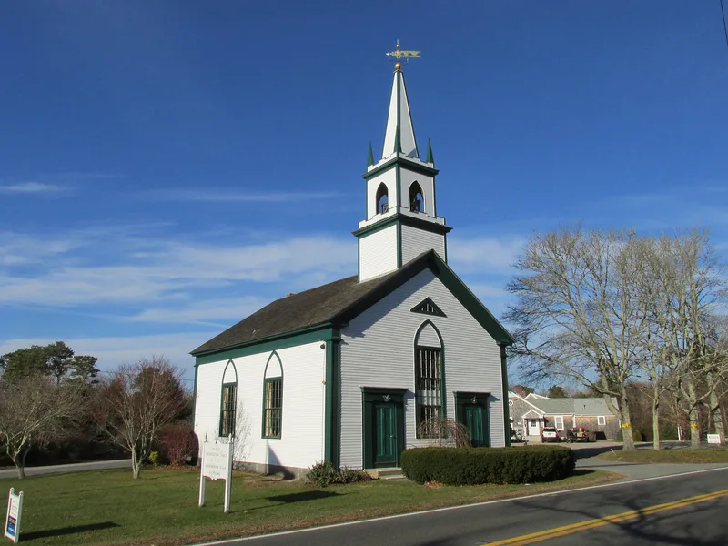
Waquoit is a village in the town of Falmouth, at the head of Waquoit Bay on Cape Cod. This historic district covers roughly 170 acres along Main Street and contains 133 resources, including 66 contributing buildings, 5 structures and 10 sites. Most buildings are single-family houses, many built in the mid-19th century when the village prospered through manufacturing, seafaring and farming. Small mills on the Childs and Moonakis Rivers turned out wagons, building parts and coffins, though the industrial buildings have since disappeared. Surviving features include the 1847 Congregational Church, early farmhouses with barns, a cemetery dating from 1840, a working cranberry bog, and the late-19th century Sargent summer estate, the district's only designed landscape. Winding, tree-shaded roads and a lot pattern little changed since the 1840s help preserve the village setting. Areas heavily altered by modern subdivision were left out of the boundaries.
Significance in brief: The district preserves the core of a village that grew around agriculture, small water-powered industry, seafaring, and later summer visitors. Most of its dwellings date to the mid-19th century, when Waquoit flourished as a manufacturing and seafaring center. Its street pattern, lot divisions, cemetery, cranberry bog, and estate landscape still convey that layered history.
Machine-generated summary. This summary was generated by a language model from the official nomination document and has not been reviewed line by line by an editor. It may contain errors. Check the source document before relying on any detail. Source: nomination document (PDF) · National Archives catalog entry. NRHP reference 04000086, listed February 26, 2004. Summary generated October 2026 (model claude-sonnet-5-5, prompt v1.0-2026-10-29, confidence medium).
Key facts
| Address | Portions of Main, Barrows, Carrige House, Collins, Martin, Moonakis, Takemmeh and Waquoit Landing, Parson, Studley, Whi, Falmouth |
|---|---|
| County | Barnstable County |
| Listed | February 26, 2004 |
| Reference number | 04000086 |
| Resource type | District |
| Period of significance | ca. 1700 - 1950 |
| Architectural style | Colonial/Georgian, Early Republic/Federal, Greek Revival, Gothic Revival, Italianate, Queen Anne |
| Areas of significance | Agriculture, Architecture, Community Planning and Development, Entertainment/Recreation, Industry |
| Level of significance | Local |
| Status (as stated in the nomination) | Most residential buildings from the period of significance remain; industrial and maritime buildings have been lost. One cranberry bog is still active, and the 1847 church, post office and cemetery uses continue. |
| Acreage | 170 |
| Coordinates | 41.58580, -70.52327 (NPS GIS) |
What listing means for this property
This is a historic district. Buildings within its boundary are either contributing (they add to the district's significance) or non-contributing. Owners of contributing income-producing buildings can claim the 20% federal rehabilitation tax credit; homeowners should look at state credits. National Register districts impose no design review by themselves; a local historic district ordinance, if one exists, does (the difference explained).
General information, not legal or tax advice. Rules change; confirm with your State Historic Preservation Office or a qualified adviser.
Sources and further reading
- National Park Service, National Register of Historic Places database (snapshot May 2026), reference 04000086.
- Nomination form (PDF, National Archives) — catalog entry
- Wikipedia article (used for cross-checking only; text not reproduced here)
- Wikidata Q7968343
- This listing as JSON
Last updated October 2026. Found an error? See the editorial policy for how to report it.