Town Hall Square Historic District Boundary Increase

Why it's listed
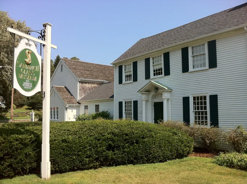
Centered on Sandwich's village core, this historic district surrounds Town Hall Square, where the 1834 Town Hall and the Dexter Grist Mill overlook Lower Shawme Lake. The 2010 amendment enlarges a district first listed in 1975 from about 50 acres by roughly 170 acres, bringing the total to 198 resources. Dwellings dominate, running from the late 17th century Hoxie House to early 20th century homes, with side-gabled Cape forms common. Greek Revival, Victorian and Colonial Revival styles also appear. Civic and religious buildings, commercial blocks along Main Street, monuments and three cemeteries add variety. The 25-acre mill lake, created by early settlers, drew early settlement and industry. In the 19th century the Boston & Sandwich Glass Company, founded in 1825, fueled growth. Managers and workers built houses in the area, while the nearby village of Jarvesville housed many factory families. Mature trees, lawns and consistent building placement give the district a cohesive character.
Significance in brief: The district shows the settlement history of Sandwich from the 17th into the 20th century. Civic buildings, houses, cemeteries and Lower Shawme Lake are grouped around the Town Hall and Dexter Grist Mill. The nearby Boston & Sandwich Glass Company, founded in 1825, shaped the commercial and residential growth of the area.
Machine-generated summary. This summary was generated by a language model from the official nomination document and has not been reviewed line by line by an editor. It may contain errors. Check the source document before relying on any detail. Source: nomination document (PDF) · National Archives catalog entry. NRHP reference 10000752, listed September 16, 2010. Summary generated October 2026 (model claude-sonnet-5-5, prompt v1.0-2026-10-29, confidence medium).
Key facts
| Address | roughly bounded by MA Rte 6A, Morse Rd, Water St, Shawme Lake, Grove St, Main St, and Tupper Rd., Sandwich |
|---|---|
| County | Barnstable County |
| Listed | September 16, 2010 |
| Reference number | 10000752 |
| Resource type | District |
| Architectural style | Federal, Greek Revival, Italianate, Queen Anne, Second Empire, Shingle Style, Colonial Revival, Bungalow |
| Areas of significance | Architecture, Community Planning and Development, Industry, Historic - Non-Aboriginal |
| Level of significance | Local |
| Status (as stated in the nomination) | Mostly residential, with commercial, civic, religious and cemetery uses continuing. Some resources were lost: 104 Tupper Road was demolished and its lot is vacant, and 19 Grove Street was replaced by a late 20th century house. |
| Acreage | 220 |
| Coordinates | 41.75662, -70.48990 (NPS GIS) |
What listing means for this property
This is a historic district. Buildings within its boundary are either contributing (they add to the district's significance) or non-contributing. Owners of contributing income-producing buildings can claim the 20% federal rehabilitation tax credit; homeowners should look at state credits. National Register districts impose no design review by themselves; a local historic district ordinance, if one exists, does (the difference explained).
General information, not legal or tax advice. Rules change; confirm with your State Historic Preservation Office or a qualified adviser.
Sources and further reading
- National Park Service, National Register of Historic Places database (snapshot May 2026), reference 10000752.
- Nomination form (PDF, National Archives) — catalog entry
- Wikipedia article (used for cross-checking only; text not reproduced here)
- Wikidata Q7829970
- This listing as JSON
Last updated October 2026. Found an error? See the editorial policy for how to report it.