Pine Grove Cemetery
Also known as: Grove Yard; South Truro Cemetery; South Side Cemetery

Why it's listed
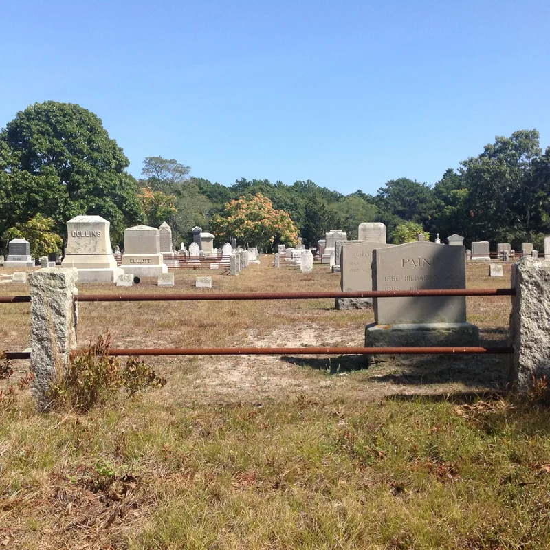
Pine Grove Cemetery is a three-acre burying ground in Leominster, Massachusetts, laid out in 1742 at the east end of the town's first meetinghouse. It grew through two expansions and closed to burials in 1937. About 800 gravestones remain, most of them 18th- and 19th-century slate and marble, carved with death's heads, winged angels, and willow and urn motifs. Four granite tombs from the 1830s and 1840s are built into a fieldstone wall that was rebuilt and extended by a 1930s WPA project. Roughly 130 mature trees and flowering shrubs shade the grounds. The cemetery matters as the oldest surviving link to Leominster's early history and as a landscape showing changing burial practices over three centuries. It holds the graves of the town's first settler, Gershom Houghton, of comb-making and early plastics pioneers, and of state legislator David Wilder. Its integrity remains high despite worn gates and shifted wall stones.
Significance in brief: It is described as the oldest remaining link to Leominster's early history and retains integrity of location, design, setting, materials and workmanship. It is significant under Criteria A and C as a cemetery whose gravestones, walls, tombs and landscape show its evolution through the 1700s, 1800s and 1900s. It also holds the graves of early comb-making and plastics pioneers and of civic leaders.
Machine-generated summary. This summary was generated by a language model from the official nomination document and has not been reviewed line by line by an editor. It may contain errors. Check the source document before relying on any detail. Source: nomination document (PDF) · National Archives catalog entry. NRHP reference 13000096, listed March 20, 2013. Summary generated October 2026 (model claude-sonnet-5-5, prompt v1.0-2026-10-29, confidence medium).
Key facts
| Address | Cemetery Rd., Truro |
|---|---|
| County | Barnstable County |
| Listed | March 20, 2013 |
| Reference number | 13000096 |
| Resource type | Site |
| Period of significance | 1742-1958 |
| Criteria |
|
| Areas of significance | Social History, Art, Community Planning and Development |
| Level of significance | Local |
| Status (as stated in the nomination) | Closed to burials in 1937; retains a high degree of historical integrity, though the city has had little money for upkeep. Gates, walls and some family plot fencing need repair. |
| Acreage | 2.1 |
| Coordinates | 41.97804, -70.05891 (NPS GIS) |
What listing means for this property
Sites (archaeological sites, battlefields, landscapes) are often listed with a restricted address to protect them from looting or disturbance. Listing is honorary for private owners; federal undertakings on or near the site go through Section 106 review, and state laws may protect burials and artefacts regardless of listing.
General information, not legal or tax advice. Rules change; confirm with your State Historic Preservation Office or a qualified adviser.
Sources and further reading
- National Park Service, National Register of Historic Places database (snapshot May 2026), reference 13000096.
- Nomination form (PDF, National Archives) — catalog entry
- Wikipedia article (used for cross-checking only; text not reproduced here)
- Wikidata Q16898446
- This listing as JSON
Last updated October 2026. Found an error? See the editorial policy for how to report it.