Half Way House

Why it's listed
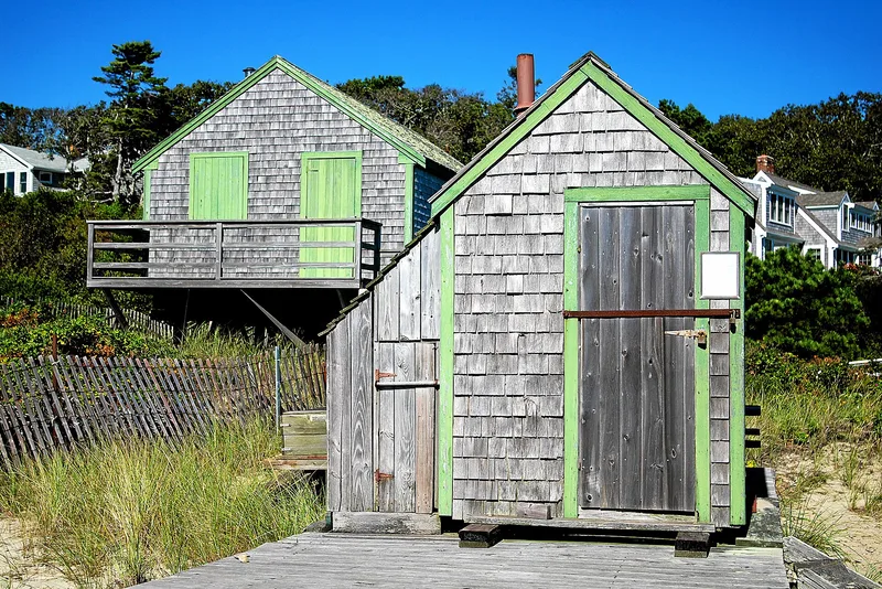
Near the foot of Andrew Harding Lane on the Pleasant Bay beach in Chatham, a tiny shingled hut about five feet square marks a piece of Cape Cod's lifesaving past. It is the last survivor of twelve halfway houses placed midway between life saving stations. Patrols walked from a station to the hut, left a tag to prove they had been there, and returned; the next patrol collected the tag. Their task was to watch for stranded or distressed vessels and sailors. Oral tradition holds that the building began as a Hut of Refuge of the Massachusetts Humane Society, stocked with food, clothing and blankets. The Coast Guard took over the service in 1915 and later stored gear here after foot patrols ended following World War II. Shifting sands of Nauset Beach forced moves around 1920 and in 1944. Later it passed to private ownership, serving a boat rental business and retired Coast Guard men as a gathering place.
Significance in brief: It is the last remaining of the original twelve halfway houses that were part of the Cape Cod lifesaving service. Halfway houses sat midway between life saving stations, where patrols left tags to prove they had walked their routes. The form evaluates its significance as local.
Machine-generated summary. This summary was generated by a language model from the official nomination document and has not been reviewed line by line by an editor. It may contain errors. Check the source document before relying on any detail. Source: nomination document (PDF) · National Archives catalog entry. NRHP reference 78000423, listed July 21, 1978. Summary generated October 2026 (model claude-sonnet-5-5, prompt v1.0-2026-10-29, confidence medium).
Key facts
| Address | Andrew Harding La., Chatham |
|---|---|
| County | Barnstable County |
| Listed | July 21, 1978 |
| Reference number | 78000423 |
| Resource type | Building |
| Period of significance | 1900- |
| Areas of significance | Communications, Social History |
| Level of significance | Local |
| Status (as stated in the nomination) | Described as in good condition and used for storage; it was reshingled in 1930 and 1975 and has been moved at least twice. |
| Acreage | 0.9 |
| Coordinates | 41.67427, -69.94718 (NPS GIS) |
What listing means for this property
National Register listing is honorary for a privately owned home: it does not by itself restrict what an owner may do with their own money, and it does not require public access. Restrictions come from local landmark or historic-district ordinances, which are separate (how they differ).
Owner-occupied houses are not eligible for the 20% federal rehabilitation tax credit, which applies to income-producing buildings, but many states offer credits for homeowners. Listing also opens the door to preservation easements and to buying a plaque. Start with what listing means for homeowners, renovating a listed house and selling one.
General information, not legal or tax advice. Rules change; confirm with your State Historic Preservation Office or a qualified adviser.
Sources and further reading
- National Park Service, National Register of Historic Places database (snapshot May 2026), reference 78000423.
- Nomination form (PDF, National Archives) — catalog entry
- Wikipedia article (used for cross-checking only; text not reproduced here)
- Wikidata Q5641761
- This listing as JSON
Last updated October 2026. Found an error? See the editorial policy for how to report it.