French Cable Hut

Why it's listed
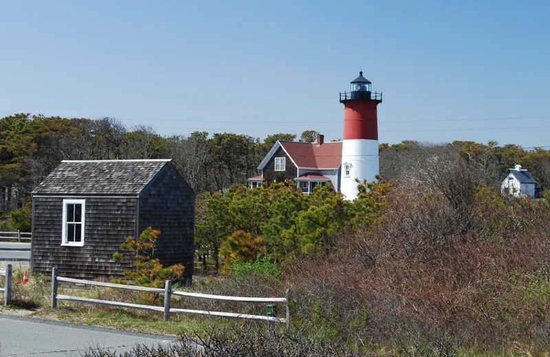
Close to Nauset Lighthouse in North Eastham, this small shingled hut served as the point where a transatlantic telegraph cable passed from sea to land. The French Cable Company laid a cable from Brest, France, through St. Pierre, Miquelon, to North Eastham in 1879. When the company moved its station facilities to Orleans in 1891, the hut became the junction linking the ocean cable to the new station. The original room measured about 14 by 12 feet, with a gable roof, and its walls still carry pencilled names, dates and circuit drawings left by cable personnel, including an entry from 1907. The ends of the old cables lie under the floor. The line was abandoned in 1932, and later additions of bedrooms, a bath and a kitchen turned the hut into a beach cottage. It was listed as the surviving remnant of the station and a link to early communications on Cape Cod.
Significance in brief: The hut was the connecting point where the transatlantic cable from Brest, France, via St. Pierre, Miquelon, came ashore and linked to the Orleans station. It is the only surviving part of the old North Eastham cable station. It records early transatlantic communications on Cape Cod, preceding Marconi's wireless station by roughly 24 years.
Machine-generated summary. This summary was generated by a language model from the official nomination document and has not been reviewed line by line by an editor. It may contain errors. Check the source document before relying on any detail. Source: nomination document (PDF) · National Archives catalog entry. NRHP reference 76000153, listed April 22, 1976. Summary generated October 2026 (model claude-sonnet-5-5, prompt v1.0-2026-10-29, confidence medium).
Key facts
| Address | E of N. Eastham at jct. of Cable Rd. and Ocean View Dr., North Eastham |
|---|---|
| County | Barnstable County |
| Listed | April 22, 1976 |
| Reference number | 76000153 |
| Resource type | Building |
| Architect / builder | Built by the French Cable Co. |
| Architectural style | Vernacular |
| Areas of significance | Communications |
| Level of significance | National |
| Status (as stated in the nomination) | Condition listed as good and altered; the front portion is original and the rear and kitchen are later additions. Now National Park Service property, with a former owner holding a two-year lease as a summer beach cottage. |
| Acreage | 1 |
| Coordinates | 41.85950, -69.95148 (NPS GIS) |
What listing means for this property
National Register listing is honorary: it recognises significance and does not restrict what a private owner may do without federal money or permits. It unlocks the 20% federal rehabilitation tax credit for income-producing buildings, state credits in many states, and Section 106 review when federal agencies are involved. See what listing means in practice.
General information, not legal or tax advice. Rules change; confirm with your State Historic Preservation Office or a qualified adviser.
Sources and further reading
- National Park Service, National Register of Historic Places database (snapshot May 2026), reference 76000153.
- Nomination form (PDF, National Archives) — catalog entry
- Wikipedia article (used for cross-checking only; text not reproduced here)
- Wikidata Q5501699
- This listing as JSON
Last updated October 2026. Found an error? See the editorial policy for how to report it.