Ancient Burying Ground
Also known as: Phinney's Lane Cemetery

Why it's listed
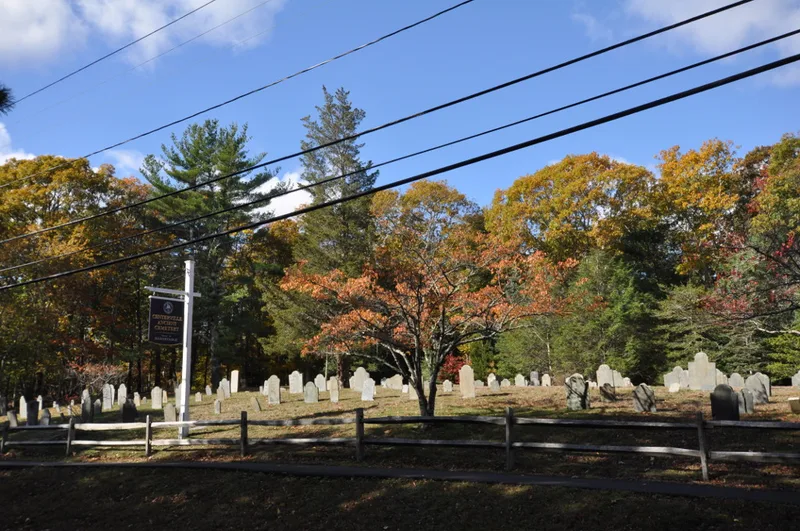
Phinney's Lane Burying Ground, also called the Ancient Burying Ground, is the oldest cemetery in Centerville, a village of Barnstable, Massachusetts. Owned by the town, it occupies about three-quarters of an acre beside the site of the village's first schoolhouse. Roughly 186 gravestones remain, the oldest marking Jonathan Hamblen, who died in 1743 at age 74. Burials continued into the 1970s. Early markers are mostly rectangular slate plates carved with death-heads, followed by winged angels; later 19th-century stones in granite or marble display urns and sweeping branches. Several memorials record men who died at sea. The cemetery is valued as the only surviving non-residential element of Centerville's original 18th-century settlement center, and for the artistic quality of its stones, which span the full range of 18th and 19th century types. A survey in the 1970s found its condition fair, with some markers breaking and about thirty fallen.
Significance in brief: The nomination argues it is the only surviving non-residential part of Centerville's original 18th-century settlement center. It is also significant for the artistic quality of its gravestones, which show the full range of 18th and 19th century types. It meets criteria A and C.
Machine-generated summary. This summary was generated by a language model from the official nomination document and has not been reviewed line by line by an editor. It may contain errors. Check the source document before relying on any detail. Source: nomination document (PDF) · National Archives catalog entry. NRHP reference 87000283, listed March 13, 1987. Summary generated October 2026 (model claude-sonnet-5-5, prompt v1.0-2026-10-29, confidence medium).
Key facts
| Address | Phinney's Ln., Barnstable |
|---|---|
| County | Barnstable County |
| Listed | March 13, 1987 |
| Reference number | 87000283 |
| Resource type | Site |
| Criteria |
|
| Areas of significance | Art, Exploration/Settlement |
| Level of significance | National, State, Local |
| Status (as stated in the nomination) | Condition described as fair: some markers are breaking and are not being repaired; about 30 stones have fallen. Most recent burial 1976. |
| Acreage | 0.8 |
| Coordinates | 41.65482, -70.34334 (NPS GIS) |
What listing means for this property
Sites (archaeological sites, battlefields, landscapes) are often listed with a restricted address to protect them from looting or disturbance. Listing is honorary for private owners; federal undertakings on or near the site go through Section 106 review, and state laws may protect burials and artefacts regardless of listing.
General information, not legal or tax advice. Rules change; confirm with your State Historic Preservation Office or a qualified adviser.
Sources and further reading
- National Park Service, National Register of Historic Places database (snapshot May 2026), reference 87000283.
- Nomination form (PDF, National Archives) — catalog entry
- Wikipedia article (used for cross-checking only; text not reproduced here)
- Wikidata Q4752808
- This listing as JSON
Last updated October 2026. Found an error? See the editorial policy for how to report it.