Eastside Historic District
Also known as: East Side

Why it's listed
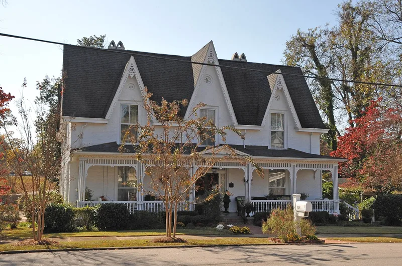
East of the Chattahoochee River and downtown West Point, this district of mostly residential streets follows a gridiron plan first laid out in 1839 by the West Point Company. College Hill, topped by the 1930 West Point School, divides the historically white neighborhood on the west from the historically African-American neighborhood on the east, where smaller lots and narrow lanes that began as alleys prevail. Housing ranges from 1850s Greek Revival and Georgian cottages to Queen Anne and New South cottages, Craftsman bungalows, shotgun houses, and mid-century Ranch houses. Community landmarks include First United Methodist Church (1907), First Baptist Church (1925), Keeney United Methodist Church, West Point High School (1951), and the Tenth Street School Lunchroom (1967). Pinewood Cemetery holds graves dating to 1840. The district's growth was tied to the railroads that made West Point a transfer point for freight and passengers, and to the bridge at East 8th Street, which linked the area to downtown from 1866 to 1977. In all, 347 resources contribute to its character.
Significance in brief: The district preserves a wide range of house types and styles reflecting the growth of West Point as a railroad transfer town, along with institutional landmarks such as churches, schools and cemeteries. It also shows the historic division between a white neighborhood in the floodplain and an African-American neighborhood east of College Hill.
Machine-generated summary. This summary was generated by a language model from the official nomination document and has not been reviewed line by line by an editor. It may contain errors. Check the source document before relying on any detail. Source: nomination document (PDF) · National Archives catalog entry. NRHP reference 12000552, listed August 28, 2012. Summary generated October 2026 (model claude-sonnet-5-5, prompt v1.0-2026-10-29, confidence medium).
Key facts
| Address | Roughly bounded by Ave. A, Ave. P, E. 12th, & E. 3rd Sts., West Point |
|---|---|
| County | Troup County |
| Listed | August 28, 2012 |
| Reference number | 12000552 |
| Resource type | District |
| Architectural style | Greek Revival, Late Victorian (Gothic, Second Empire, Queen Anne, Romanesque), Colonial Revival, Classical Revival, Tudor Revival, Spanish Colonial Revival, Bungalow/Craftsman, International Style, plus vernacular house types |
| Areas of significance | Architecture, Community Planning and Development, Black |
| Level of significance | Local |
| Status (as stated in the nomination) | Still largely in residential use, with churches, a cemetery still in use, a mortuary and small corner businesses; 347 contributing and 96 noncontributing resources. |
| Acreage | 234 |
| Coordinates | 32.87462, -85.17249 (NPS GIS) |
What listing means for this property
This is a historic district. Buildings within its boundary are either contributing (they add to the district's significance) or non-contributing. Owners of contributing income-producing buildings can claim the 20% federal rehabilitation tax credit; homeowners should look at state credits. National Register districts impose no design review by themselves; a local historic district ordinance, if one exists, does (the difference explained).
General information, not legal or tax advice. Rules change; confirm with your State Historic Preservation Office or a qualified adviser.
Sources and further reading
- National Park Service, National Register of Historic Places database (snapshot May 2026), reference 12000552.
- Nomination form (PDF, National Archives) — catalog entry
- Wikidata Q141810725
- This listing as JSON
Last updated October 2026. Found an error? See the editorial policy for how to report it.