West Darien Historic District

Why it's listed
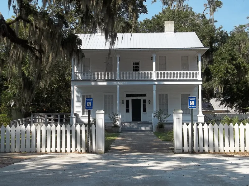
West Darien is the western section of the coastal Georgia town of Darien, laid out on a gridiron plan surveyed in 1806 by Thomas McCall. Union troops burned the town in 1863, so nearly all surviving buildings date from after the Civil War, mainly 1870 to 1910, when Darien thrived as a timber-exporting port. The district includes a commercial area along Broad Street and U.S. 17, white residential streets of mostly wooden cottages and bungalows, and Mentionville, an African-American neighborhood of shotgun, hall-parlor and central-hall houses near former sawmills. Bayard Square, home to the First Presbyterian Church, survives as the district's public square. Prehistoric shell middens and historic archaeological sites lie along Cathead Creek and the river bluff. The district was listed for its links to Darien's changing industries, its early planned town layout, its African-American heritage, its representative architecture, and the information its archaeological sites have provided.
Significance in brief: The nomination argues the district reflects Darien's economic development through cotton, timber, shipping, fishing and early highway tourism. It keeps an intact 1806 gridiron plan and the African-American Mentionville neighborhood. It also has good examples of residential, commercial and community buildings, and archaeological sites that have yielded information.
Machine-generated summary. This summary was generated by a language model from the official nomination document and has not been reviewed line by line by an editor. It may contain errors. Check the source document before relying on any detail. Source: nomination document (PDF) · National Archives catalog entry. NRHP reference 01000975, listed September 17, 2001. Summary generated October 2026 (model claude-sonnet-5-5, prompt v1.0-2026-10-29, confidence medium).
Key facts
| Address | Bounded by 8th St., US 17, Darien River, and Cathead Creek, Darien |
|---|---|
| County | McIntosh County |
| Listed | September 17, 2001 |
| Reference number | 01000975 |
| Resource type | District |
| Architectural style | Late 19th and Early 20th Century Revivals/Colonial Revival; Late 19th and Early 20th Century American Movements/Bungalow/Craftsman |
| Criteria |
|
| Areas of significance | Prehistoric, Historic - Non-Aboriginal, Architecture, Community Planning and Development, Commerce, Black |
| Level of significance | State |
| Status (as stated in the nomination) | Current uses include single dwellings, businesses, professional offices, specialty stores and religious facilities. |
| Acreage | 94 |
| Coordinates | 31.37242, -81.43604 (NPS GIS) |
What listing means for this property
This is a historic district. Buildings within its boundary are either contributing (they add to the district's significance) or non-contributing. Owners of contributing income-producing buildings can claim the 20% federal rehabilitation tax credit; homeowners should look at state credits. National Register districts impose no design review by themselves; a local historic district ordinance, if one exists, does (the difference explained).
General information, not legal or tax advice. Rules change; confirm with your State Historic Preservation Office or a qualified adviser.
Sources and further reading
- National Park Service, National Register of Historic Places database (snapshot May 2026), reference 01000975.
- Nomination form (PDF, National Archives) — catalog entry
- Wikipedia article (used for cross-checking only; text not reproduced here)
- Wikidata Q22058948
- This listing as JSON
Last updated October 2026. Found an error? See the editorial policy for how to report it.