Fort King George

Why it's listed
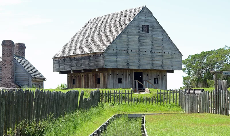
Fort King George occupies a 12-acre bluff above the Altamaha River near Darien, Georgia. The site layers several chapters of coastal history. Guale or Yamasee Indians lived there first, and a Spanish mission followed in the 17th century; 1952 excavations suggest it may have been Tolomato. In 1721 Colonel John Barnwell began building an English fort, intended to claim the disputed land against French and Spanish designs. The fort had a cypress blockhouse, a moat and a palisade. About 140 soldiers died there before the garrison withdrew in 1727, and excavators found 81 skeletons nearby. In 1736 Oglethorpe sent Scottish Highlanders, who founded Darien and ran sawmills until the early 20th century. The exact location was forgotten until local historians found it in the mid-1930s, and the state bought the tract. Today a 1968 museum and markers interpret the mission, fort and sawmill remains, and this long record of use is why the site was listed.
Significance in brief: The nomination calls it Georgia's first English settlement and the first effort to establish Britain's claim to the "debatable land" in the Southeast. The site also holds evidence of Indian occupation, a Spanish mission possibly connected to Tolomato, and Scottish Highlanders' sawmill operations that lasted until the early 20th century.
Machine-generated summary. This summary was generated by a language model from the official nomination document and has not been reviewed line by line by an editor. It may contain errors. Check the source document before relying on any detail. Source: nomination document (PDF) · National Archives catalog entry. NRHP reference 71001101, listed December 9, 1971. Summary generated October 2026 (model claude-sonnet-5-5, prompt v1.0-2026-10-29, confidence high).
Key facts
| Address | E of U.S. 17, Darien |
|---|---|
| County | McIntosh County |
| Listed | December 9, 1971 |
| Reference number | 71001101 |
| Resource type | Site |
| Period of significance | c.1650-1686; 1721-1727; c.1736-c.1920 |
| Architect / builder | Museum designed by Gunn and Meyerhoff, AIA; fort construction led by Colonel John Barnwell in 1721 |
| Areas of significance | Industry, Prehistoric, Historic - Non-Aboriginal, Military, Exploration/Settlement, Politics/Government |
| Level of significance | National |
| Status (as stated in the nomination) | Owned by the Georgia Historical Commission and used as a museum; open to the public with restricted access. A museum was built in 1968, and only remnants of the sawmill brick foundations survive. |
| Acreage | 12 |
| Coordinates | 31.36519, -81.41548 (NPS GIS) |
What listing means for this property
Sites (archaeological sites, battlefields, landscapes) are often listed with a restricted address to protect them from looting or disturbance. Listing is honorary for private owners; federal undertakings on or near the site go through Section 106 review, and state laws may protect burials and artefacts regardless of listing.
General information, not legal or tax advice. Rules change; confirm with your State Historic Preservation Office or a qualified adviser.
Sources and further reading
- National Park Service, National Register of Historic Places database (snapshot May 2026), reference 71001101.
- Nomination form (PDF, National Archives) — catalog entry
- Wikipedia article (used for cross-checking only; text not reproduced here)
- Wikidata Q5471428
- This listing as JSON
Last updated October 2026. Found an error? See the editorial policy for how to report it.