Reynoldstown Historic District
Also known as: Tin Cup Alley; Slide

Why it's listed
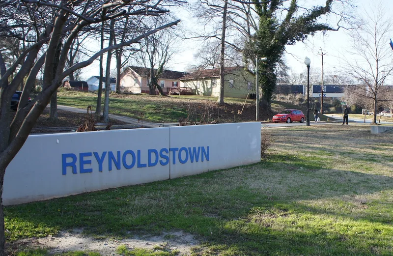
Reynoldstown is a residential neighborhood of roughly 190 acres in Atlanta, shaped by the railroad lines that run through it. Freedmen who took railroad jobs after the Civil War settled the northwest corner around Chester Avenue and Selman, Kenyon and Wylie streets from about 1870. East of the Atlanta and West Point rail corridor, small subdivisions built between 1905 and 1930 filled with Craftsman bungalows for white middle- and working-class families. Other building types include shotgun houses, saddlebag houses, Tudor and Colonial Revival homes, brick commercial blocks, churches and two schools. After World War II, white residents moved to outlying suburbs, and by 1960 the area was almost entirely African American. The district was recognized for this record of settlement and racial change, and for its largely intact street plan and historic buildings, which date from 1870 to 1960.
Significance in brief: The nomination argues the district is significant in social history and Black ethnic heritage because it reflects post-Civil War African-American settlement along the rail lines and the mid-20th-century 'white flight.' It went from a mostly white neighborhood after World War II to almost entirely African American by 1960. It is also significant in architecture and community planning for its intact bungalows, shotgun houses and other vernacular types.
Machine-generated summary. This summary was generated by a language model from the official nomination document and has not been reviewed line by line by an editor. It may contain errors. Check the source document before relying on any detail. Source: nomination document (PDF) · National Archives catalog entry. NRHP reference 02001405, listed April 3, 2003. Summary generated October 2026 (model claude-sonnet-5-5, prompt v1.0-2026-10-29, confidence high).
Key facts
| Address | Roughly bounded by the CSX rail line, Memorial Dr., Pearl St., and Moreland, Atlanta |
|---|---|
| County | Fulton County |
| Listed | April 3, 2003 |
| Reference number | 02001405 |
| Resource type | District |
| Period of significance | 1870-1960 |
| Architect / builder | William J.J. Chase (architect) |
| Architectural style | Late Victorian: Romanesque; Colonial Revival, Tudor Revival; Bungalow/Craftsman; International Style; vernacular house types (gabled-ell, pyramidal cottage, side-gable cottage, saddlebag, double-pen, shotgun) |
| Criteria |
|
| Areas of significance | Black, Social History, Community Planning and Development, Architecture |
| Level of significance | Local |
| Status (as stated in the nomination) | Described as retaining a high level of historic integrity, with many vacant lots and many corner stores vacant. Still used for residential, commercial, religious and industrial purposes. |
| Acreage | 190 |
| Coordinates | 33.75583, -84.35236 (NPS GIS) |
What listing means for this property
This is a historic district. Buildings within its boundary are either contributing (they add to the district's significance) or non-contributing. Owners of contributing income-producing buildings can claim the 20% federal rehabilitation tax credit; homeowners should look at state credits. National Register districts impose no design review by themselves; a local historic district ordinance, if one exists, does (the difference explained).
General information, not legal or tax advice. Rules change; confirm with your State Historic Preservation Office or a qualified adviser.
Sources and further reading
- National Park Service, National Register of Historic Places database (snapshot May 2026), reference 02001405.
- Nomination form (PDF, National Archives) — catalog entry
- Wikipedia article (used for cross-checking only; text not reproduced here)
- Wikidata Q7319695
- This listing as JSON
Last updated October 2026. Found an error? See the editorial policy for how to report it.