Inman Park

Why it's listed
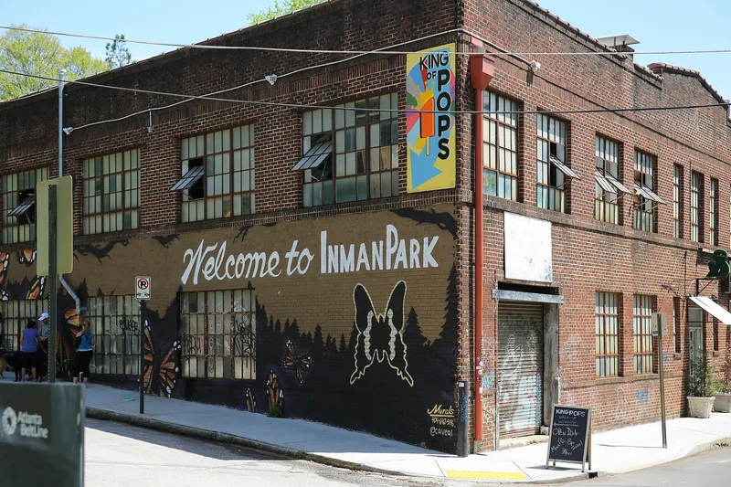
Inman Park is a residential neighborhood near the eastern edge of Atlanta, connected to the downtown Five Points area by Edgewood Avenue. Developed from 1889 by Joel Hurt's East Atlanta Land Company, it was the city's first planned residential suburb. Hurt tied it to an electric street railway and a downtown skyscraper, the Equitable Building. Curving streets, rolling terrain, large shade trees and green spaces such as Springvale Park, the Triangle and the Delta give the area a picturesque character. Its houses range from High Victorian Queen Anne and Colonial Revival designs to Jacobethan and Beaux-Arts examples, plus a c. 1890 shingle style car barn and the Inman Park School by G. L. Norrman. Prominent Atlantans, including members of the Candler family, lived here. After deed restrictions lapsed in 1910, apartments and businesses appeared, and many families moved away. A restoration movement began around 1970, and a 1961 road embankment cut through Springvale Park.
Significance in brief: It was the first planned residential suburb developed in Atlanta, promoted by Joel Hurt as part of a larger scheme that included an electric street railway and a skyscraper office building. It retains many 1890-1910 houses, a picturesque street pattern, and green spaces, and was home to prominent Atlanta families. Its architecture and landscape design are also cited.
Machine-generated summary. This summary was generated by a language model from the official nomination document and has not been reviewed line by line by an editor. It may contain errors. Check the source document before relying on any detail. Source: nomination document (PDF) · National Archives catalog entry. NRHP reference 73000621, listed July 23, 1973. Summary generated October 2026 (model claude-sonnet-5-5, prompt v1.0-2026-10-29, confidence high).
Key facts
| Address | Roughly bounded by I-485, DeKalb and Lake Aves., Atlanta |
|---|---|
| County | Fulton County |
| Listed | July 23, 1973 |
| Reference number | 73000621 |
| Resource type | District |
| Period of significance | 1890 - 1973 |
| Architect / builder | Joel Hurt (developer); James Forsyth Johnson (landscape designer); W. T. Downing; G. L. Norrman; Olmsted Brothers (grounds of the Hurt House) |
| Architectural style | High Victorian Queen Anne, Colonial Revival, Jacobethan Revival, Beaux-Arts classical, Prairie School influence, shingle style, and early twentieth century bungalows |
| Areas of significance | Community Planning and Development, Landscape Architecture, Architecture |
| Level of significance | State |
| Status (as stated in the nomination) | Occupied, mostly private residences with some commercial, religious and other uses; condition rated fair and altered. Restoration of older homes is under way. |
| Acreage | 180 |
| Coordinates | 33.75526, -84.35909 (NPS GIS) |
What listing means for this property
This is a historic district. Buildings within its boundary are either contributing (they add to the district's significance) or non-contributing. Owners of contributing income-producing buildings can claim the 20% federal rehabilitation tax credit; homeowners should look at state credits. National Register districts impose no design review by themselves; a local historic district ordinance, if one exists, does (the difference explained).
General information, not legal or tax advice. Rules change; confirm with your State Historic Preservation Office or a qualified adviser.
Sources and further reading
- National Park Service, National Register of Historic Places database (snapshot May 2026), reference 73000621.
- Nomination form (PDF, National Archives) — catalog entry
- Wikipedia article (used for cross-checking only; text not reproduced here)
- Wikidata Q6035046
- This listing as JSON
Last updated October 2026. Found an error? See the editorial policy for how to report it.