Myrtle Hill Cemetery

Why it's listed
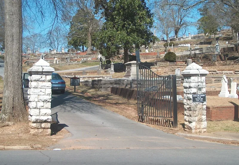
Myrtle Hill Cemetery occupies a steep hillside in South Rome, Georgia, near the point where the Etowah and Oostanaula Rivers meet to form the Coosa. The City of Rome bought the land in the early 1850s to replace Oak Hill, the original cemetery, which had become too small as the town grew. Colonel C.M. Pennington designed about half of the present cemetery in the picturesque rural style, with curving drives, stone terracing and informal landscaping. Later additions followed his approach, so the grounds look unified. Iron fences, many made locally by the Noble and McCoullough Foundry, and a long flight of steps at the east entrance add to the park-like setting. Seven marble vaults built between 1891 and 1940, most by the McNeel Marble Company of Marietta, represent typical funerary architecture. The cemetery also includes a large Confederate section and areas for paupers and Black residents. It was listed for community planning, landscape architecture and architecture.
Significance in brief: The nomination argues it was a major component of Rome's early town plan and an important early Georgia example of a picturesque "rural" cemetery. It also holds a group of seven late-nineteenth and early-twentieth century marble vaults typical of funerary architecture of the period. Its curving layout contrasts with Rome's otherwise gridiron street plan.
Machine-generated summary. This summary was generated by a language model from the official nomination document and has not been reviewed line by line by an editor. It may contain errors. Check the source document before relying on any detail. Source: nomination document (PDF) · National Archives catalog entry. NRHP reference 83000196, listed September 1, 1983. Summary generated October 2026 (model claude-sonnet-5-5, prompt v1.0-2026-10-29, confidence high).
Key facts
| Address | Bounded by S. Broad, and Myrtle Sts., Pennington, and Branham Aves., Rome |
|---|---|
| County | Floyd County |
| Listed | September 1, 1983 |
| Reference number | 83000196 |
| Resource type | District |
| Period of significance | 1850s to present |
| Architect / builder | Col. C.M. Pennington |
| Criteria |
|
| Areas of significance | Community Planning and Development, Landscape Architecture, Architecture |
| Level of significance | Local |
| Status (as stated in the nomination) | Listed as occupied and in use as a cemetery, with the northern edge used as a city park; condition marked excellent, good and fair, with some deterioration and alteration noted. |
| Acreage | 22 |
| Coordinates | 34.25257, -85.17948 (NPS GIS) |
What listing means for this property
This is a historic district. Buildings within its boundary are either contributing (they add to the district's significance) or non-contributing. Owners of contributing income-producing buildings can claim the 20% federal rehabilitation tax credit; homeowners should look at state credits. National Register districts impose no design review by themselves; a local historic district ordinance, if one exists, does (the difference explained).
General information, not legal or tax advice. Rules change; confirm with your State Historic Preservation Office or a qualified adviser.
Sources and further reading
- National Park Service, National Register of Historic Places database (snapshot May 2026), reference 83000196.
- Nomination form (PDF, National Archives) — catalog entry
- Wikipedia article (used for cross-checking only; text not reproduced here)
- Wikidata Q6948625
- This listing as JSON
Last updated October 2026. Found an error? See the editorial policy for how to report it.