Between the Rivers Historic District
Also known as: See Also:Between the Rivers Historic District (Boundary Incr

Why it's listed
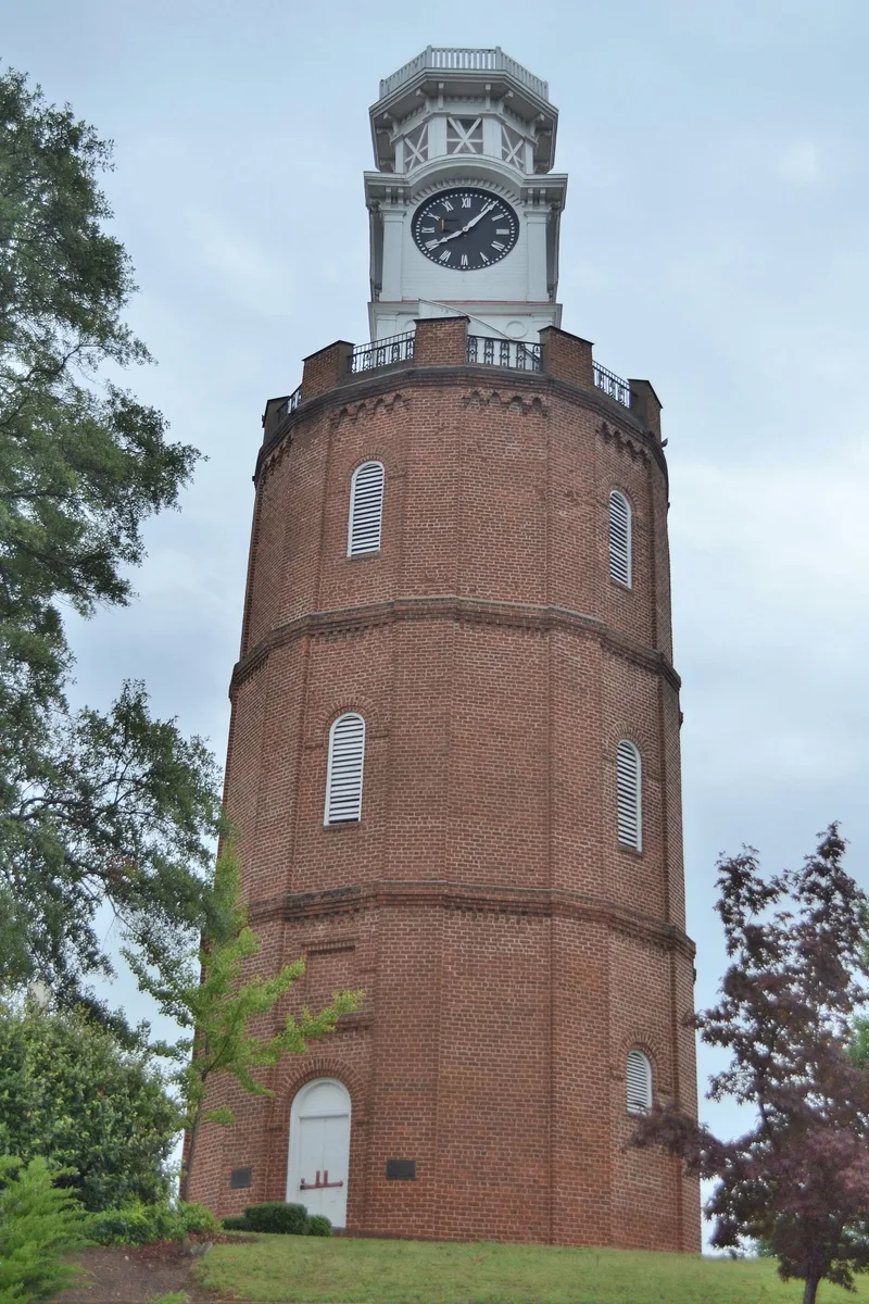
Between the Rivers is the original core of Rome, Georgia, a hilly area of roughly 90 acres platted in 1834 where the Etowah and Oostanaula Rivers meet. Its grid of streets survives, with Broad Street forming the commercial spine of brick buildings from the 1870s to the 1930s. Residential blocks on the hills hold Greek Revival, Queen Anne and Neoclassical houses, set among stone retaining walls and informal plantings. Civic buildings include the old Floyd County Courthouse, the Municipal Building and a Carnegie library, while warehouses and factories recall the city's industrial growth. The 1871 Clock Tower, once part of north Georgia's first public waterworks, and two early bridges add engineering interest. A surviving cottage from Dr. Robert Battey's Woman's Hospital recalls his medical work. The district was listed for showing how Rome grew from a planned river town into a prosperous regional trade center before the Depression halted development.
Significance in brief: The district shows the full development of Rome from its 1834 founding through the 1930s, as a planned county seat and regional commercial and industrial center. It is also significant for its architecture, residential landscaping, engineering (the Clock Tower and two bridges), local government, and a building tied to physician Dr. Robert Battey. It may also hold archaeological potential under the Broad Street commercial area.
Machine-generated summary. This summary was generated by a language model from the official nomination document and has not been reviewed line by line by an editor. It may contain errors. Check the source document before relying on any detail. Source: nomination document (PDF) · National Archives catalog entry. NRHP reference 83000193, listed June 9, 1983. Summary generated October 2026 (model claude-sonnet-5-5, prompt v1.0-2026-10-29, confidence high).
Key facts
| Address | Roughly bounded by the Etowah and Oostanaula Rivers, and 7th Ave., Rome |
|---|---|
| County | Floyd County |
| Listed | June 9, 1983 |
| Reference number | 83000193 |
| Resource type | District |
| Period of significance | 1834-1930s |
| Architect / builder | Multiple |
| Architectural style | Greek Revival, Gothic Revival, Second Empire, Queen Anne, Victorian Commercial, Neoclassical, Bungalow/Craftsman |
| Criteria |
|
| Areas of significance | Industry, Community Planning and Development, Commerce, Engineering, Transportation, Health/Medicine, Politics/Government, Architecture, Social History |
| Level of significance | State |
| Status (as stated in the nomination) | Condition is marked excellent, good and fair, and the district is occupied. Some commercial buildings have been altered, and a few modern intrusions exist. |
| Acreage | 90 |
| Coordinates | 34.25550, -85.17029 (NPS GIS) |
What listing means for this property
This is a historic district. Buildings within its boundary are either contributing (they add to the district's significance) or non-contributing. Owners of contributing income-producing buildings can claim the 20% federal rehabilitation tax credit; homeowners should look at state credits. National Register districts impose no design review by themselves; a local historic district ordinance, if one exists, does (the difference explained).
General information, not legal or tax advice. Rules change; confirm with your State Historic Preservation Office or a qualified adviser.
Sources and further reading
- National Park Service, National Register of Historic Places database (snapshot May 2026), reference 83000193.
- Nomination form (PDF, National Archives) — catalog entry
- Wikipedia article (used for cross-checking only; text not reproduced here)
- Wikidata Q34843154
- This listing as JSON
Last updated October 2026. Found an error? See the editorial policy for how to report it.