Alviso Historic District
Also known as: Embarcadero de Santa Clara

Why it's listed
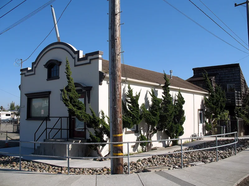
Alviso is an old bay port town laid out on a grid at the head of a navigable slough at the south end of San Francisco Bay. The nominated district runs along Alviso Slough, the 1850 canal and the Guadalupe River, and holds many buildings from the town's 1849-1900 heyday. These include the Old Union Warehouse and docks (about 1858), the Laine residence and store, the Railroad Depot (1904), the South Bay Yacht Club (1905), Wade's house and warehouse, and the Constable Office and Jail. The port was known by 1792, when Vancouver noted a rivulet near Santa Clara Mission with the confines of a port, and it handled hides and tallow for the mission. It became the principal freight and passenger link between San Francisco and the southern bay and the main shipping depot for the Santa Clara Valley. Port activity slowed in the 1880s and 1890s because of railroad competition, and the town still looks much as it did then.
Significance in brief: The nomination calls Alviso one of the earliest ports on the U.S. West Coast, predating San Francisco, and the main passenger and freight link between San Francisco and the southern bay area. It was also the chief commercial shipping depot for the Santa Clara Valley. The nomination argues the town remains a virtually unchanged, unsuburbanized California port town that looks much as it did in 1880-90.
Machine-generated summary. This summary was generated by a language model from the official nomination document and has not been reviewed line by line by an editor. It may contain errors. Check the source document before relying on any detail. Source: nomination document (PDF) · National Archives catalog entry. NRHP reference 73000449, listed October 9, 1973. Summary generated October 2026 (model claude-sonnet-5-5, prompt v1.0-2026-10-29, confidence medium).
Key facts
| Address | Boundaries unknown at this time, Alviso |
|---|---|
| County | Santa Clara County |
| Listed | October 9, 1973 |
| Reference number | 73000449 |
| Resource type | District |
| Period of significance | 18th and 19th centuries (1792 to about 1900) |
| Areas of significance | Transportation |
| Level of significance | State |
| Status (as stated in the nomination) | Condition marked as deteriorated. Present uses include boating, fishing, clamming, shell collecting and commercial and industrial activity. The slough shelters transportation boats and the South Bay Yacht Club. |
| Acreage | 9 |
| Coordinates | 37.42494, -121.96774 (NPS GIS) |
What listing means for this property
This is a historic district. Buildings within its boundary are either contributing (they add to the district's significance) or non-contributing. Owners of contributing income-producing buildings can claim the 20% federal rehabilitation tax credit; homeowners should look at state credits. National Register districts impose no design review by themselves; a local historic district ordinance, if one exists, does (the difference explained).
General information, not legal or tax advice. Rules change; confirm with your State Historic Preservation Office or a qualified adviser.
Sources and further reading
- National Park Service, National Register of Historic Places database (snapshot May 2026), reference 73000449.
- Nomination form (PDF, National Archives) — catalog entry
- Wikidata Q114414649
- This listing as JSON
Last updated October 2026. Found an error? See the editorial policy for how to report it.