Santa Barbara Presidio

Why it's listed
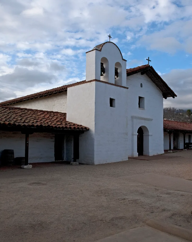
Four blocks of downtown Santa Barbara mark the site of the Royal Presidio, a Spanish fort founded in 1782 as the fourth and last presidio of Alta California. Captain Felipe de Goycoechea began a permanent adobe quadrangle in 1788, with barracks, family quarters, officers' houses and a chapel around a central plaza, enclosed by defense walls and bastions. Most of it was complete by 1790, and the chapel was enlarged in 1797 after a fire. The presidio guarded a military district of about 7,000 square miles and remained in use until 1850. Two original buildings survive in restored form: El Cuartel, a soldiers' family quarter, and the Caneda Adobe, a former officer's quarters. Excavations have uncovered chapel foundations and both defense walls. The detailed original plans allow accurate reconstruction, and the area remains the historical center of the city. It is listed as a district.
Significance in brief: It was the fourth and last presidio founded during the Spanish colonization of Alta California, and it remained in use until 1850, longer than the other three. Its design and construction are unusually well documented, which supports accurate reconstruction. The site also remained the historical center of the city of Santa Barbara and has ongoing archaeological value.
Machine-generated summary. This summary was generated by a language model from the official nomination document and has not been reviewed line by line by an editor. It may contain errors. Check the source document before relying on any detail. Source: nomination document (PDF) · National Archives catalog entry. NRHP reference 73000455, listed November 26, 1973. Summary generated October 2026 (model claude-sonnet-5-5, prompt v1.0-2026-10-29, confidence medium).
Key facts
| Address | Roughly bounded by Carrillo, Garden, De la Guerra and Anacapa Sts., Santa Barbara |
|---|---|
| County | Santa Barbara County |
| Listed | November 26, 1973 |
| Reference number | 73000455 |
| Resource type | District |
| Period of significance | 18th and 19th centuries; specific dates 1788 and 1850 |
| Architect / builder | Captain Felipe de Goycoechea (plan of 1788); Captain Francisco Ortega (initial temporary barracks and palisade) |
| Areas of significance | Community Planning and Development, Historic - Aboriginal, Military, Architecture |
| Level of significance | State |
| Status (as stated in the nomination) | Mixed use: some original buildings (El Cuartel, Caneda Adobe) are restored, and excavation of foundations is ongoing. Other lots hold parking lots, commercial buildings, residences, a post office and college classrooms. |
| Acreage | 5.4 |
| Coordinates | 34.42261, -119.69807 (NPS GIS) |
What listing means for this property
This is a historic district. Buildings within its boundary are either contributing (they add to the district's significance) or non-contributing. Owners of contributing income-producing buildings can claim the 20% federal rehabilitation tax credit; homeowners should look at state credits. National Register districts impose no design review by themselves; a local historic district ordinance, if one exists, does (the difference explained).
General information, not legal or tax advice. Rules change; confirm with your State Historic Preservation Office or a qualified adviser.
Sources and further reading
- National Park Service, National Register of Historic Places database (snapshot May 2026), reference 73000455.
- Nomination form (PDF, National Archives) — catalog entry
- Wikipedia article (used for cross-checking only; text not reproduced here)
- Wikidata Q3402430
- This listing as JSON
Last updated October 2026. Found an error? See the editorial policy for how to report it.