Union Cemetery

Why it's listed
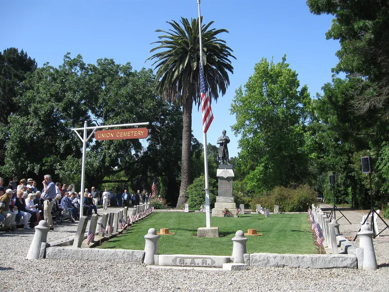
Union Cemetery, a triangular burial ground of about 6.5 acres on Woodside Road in Redwood City, was established in 1859 after villagers lost access to an informal burial plot on land owned by Horace Hawes. They named it "Union" and bought six acres for $500, deeding the title in trust to the Governor of California. The effort coincided with the state's first cemetery legislation. Between 1,700 and 2,000 burials are estimated, including pioneers from at least seventeen foreign countries and twenty-six states, plus founders of Woodside and Searsville. Plots were set aside for Civil War veterans, Masons and Odd Fellows. A Civil War soldier statue erected in the 1880s was destroyed by vandals three times, and its pieces are now in the county museum. Burials ended in 1959, and vandalism and neglect have taken a toll. The cemetery remains the endpoint of Redwood City's Memorial Day ceremony and preserves records of early settlement.
Significance in brief: The nomination argues the cemetery matters for historic archaeology, settlement patterns and social history. Its records show the varied origins of early settlers, and it was tied to California's first cemetery legislation. It is also the site of a long-running Memorial Day ceremony at the Civil War veterans' plot.
Machine-generated summary. This summary was generated by a language model from the official nomination document and has not been reviewed line by line by an editor. It may contain errors. Check the source document before relying on any detail. Source: nomination document (PDF) · National Archives catalog entry. NRHP reference 83001237, listed August 25, 1983. Summary generated October 2026 (model claude-sonnet-5-5, prompt v1.0-2026-10-29, confidence medium).
Key facts
| Address | 316 Woodside Rd., Redwood City |
|---|---|
| County | San Mateo County |
| Listed | August 25, 1983 |
| Reference number | 83001237 |
| Resource type | Site |
| Period of significance | 1859 to 1959 |
| Areas of significance | Community Planning and Development, Historic - Non-Aboriginal, Social History |
| Level of significance | State |
| Status (as stated in the nomination) | Described as deteriorated and heavily vandalized, with the last burial in 1959; the form lists it as unoccupied and used as a park and for religious purposes. An annual Memorial Day gathering continues. |
| Acreage | 6.5 |
| Coordinates | 37.47361, -122.22357 (NPS GIS) |
What listing means for this property
Sites (archaeological sites, battlefields, landscapes) are often listed with a restricted address to protect them from looting or disturbance. Listing is honorary for private owners; federal undertakings on or near the site go through Section 106 review, and state laws may protect burials and artefacts regardless of listing.
General information, not legal or tax advice. Rules change; confirm with your State Historic Preservation Office or a qualified adviser.
Sources and further reading
- National Park Service, National Register of Historic Places database (snapshot May 2026), reference 83001237.
- Nomination form (PDF, National Archives) — catalog entry
- Wikipedia article (used for cross-checking only; text not reproduced here)
- Wikidata Q7885467
- This listing as JSON
Last updated October 2026. Found an error? See the editorial policy for how to report it.