Sanchez Adobe Park
Also known as: Pruristac,San Pedro y San Pablo

Why it's listed
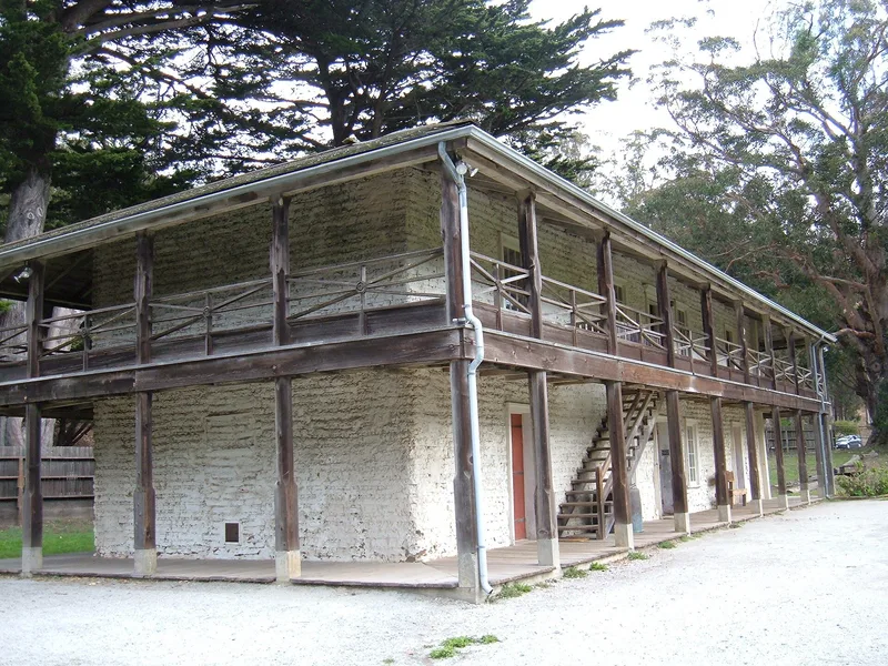
Sanchez Adobe Park in Pacifica protects three layers of California history on about five acres. The centerpiece is a two-story adobe, 22 by 64 feet, built by Francisco Sanchez between 1842 and 1846 with thick sun-dried brick walls on a local stone foundation. Nearby lie a Costanoan village site, thought to be Pruristac, and the foundations of a quadrangle used by Mission Dolores as an agricultural outpost from about 1786 to 1828. The outpost is the only known surviving example of its kind on the San Francisco peninsula, and the village is the only known ethnographic village in the region. Sanchez, a military officer and alcalde of San Francisco, was involved in a local skirmish with American forces in 1846. Later the adobe served as a ranch house, a hotel, a bootleg saloon and an artichoke shed. San Mateo County bought it in 1946 and restored it in 1953. It now operates as a park and museum.
Significance in brief: The park contains evidence of every major period of human occupation in California, from the Costanoan Indians through the Mission, Mexican, Spanish and American periods. The outpost is the only known surviving remnant of a series of Mission Dolores outposts on the San Francisco peninsula. The adobe is described as the finest example of its type in San Mateo County and is tied to Francisco Sanchez and the Mexican-American War.
Machine-generated summary. This summary was generated by a language model from the official nomination document and has not been reviewed line by line by an editor. It may contain errors. Check the source document before relying on any detail. Source: nomination document (PDF) · National Archives catalog entry. NRHP reference 76000525, listed April 13, 1976. Summary generated October 2026 (model claude-sonnet-5-5, prompt v1.0-2026-10-29, confidence medium).
Key facts
| Address | Linda Mar Blvd., 1 mi. E of CA 1, Pacifica |
|---|---|
| County | San Mateo County |
| Listed | April 13, 1976 |
| Reference number | 76000525 |
| Resource type | District |
| Architect / builder | Francisco Sanchez (owner-builder) |
| Areas of significance | Agriculture, Military, Politics/Government, Architecture |
| Level of significance | State |
| Status (as stated in the nomination) | Restored in 1953 and open to the public without admission charge as a local history and house museum within a county park; described as in excellent condition. |
| Acreage | 5 |
| Coordinates | 37.58757, -122.49355 (NPS GIS) |
What listing means for this property
This is a historic district. Buildings within its boundary are either contributing (they add to the district's significance) or non-contributing. Owners of contributing income-producing buildings can claim the 20% federal rehabilitation tax credit; homeowners should look at state credits. National Register districts impose no design review by themselves; a local historic district ordinance, if one exists, does (the difference explained).
General information, not legal or tax advice. Rules change; confirm with your State Historic Preservation Office or a qualified adviser.
Sources and further reading
- National Park Service, National Register of Historic Places database (snapshot May 2026), reference 76000525.
- Nomination form (PDF, National Archives) — catalog entry
- Wikipedia article (used for cross-checking only; text not reproduced here)
- Wikidata Q7665252
- This listing as JSON
Last updated October 2026. Found an error? See the editorial policy for how to report it.