Grand Boulevard Historic District

Why it's listed
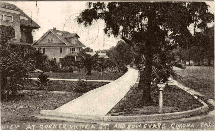
Grand Boulevard is a circular roadway in Corona, California, laid out in 1886 about 40 miles east of Los Angeles. The ring measures one mile across with a 100-foot-wide right-of-way, and it surrounds a grid of interior streets while exterior streets meet its outer edge at various angles. The district includes the roadway, intersecting streets and alleys, driveways, curbs and gutters, parkways, sidewalks, street trees, historic streetlights, a granite hitching post and two pocket parks. Palms, silk oaks, peppers, eucalyptus and other trees line much of the circle, and 146 historic-style lamps remain from a late-1920s lighting project. The roadway was originally dirt, later oiled and paved. A monument marks the start and finish line of the 1913, 1914 and 1916 Corona road races. Location, design, setting and association remain strong, though the State Route 91 bridges, widening and new signals have altered the northern section.
Significance in brief: The nomination presents the boulevard as a locally significant planned circular roadway with its original design and early features still in place. The excerpt does not include the Section 8 text, but it ties the boulevard to the 1913, 1914 and 1916 Corona road races. It also notes retained integrity of location, design, setting and association.
Machine-generated summary. This summary was generated by a language model from the official nomination document and has not been reviewed line by line by an editor. It may contain errors. Check the source document before relying on any detail. Source: nomination document (PDF) · National Archives catalog entry. NRHP reference 11000432, listed July 14, 2011. Summary generated October 2026 (model claude-sonnet-5-5, prompt v1.0-2026-10-29, confidence medium).
Key facts
| Address | Grand Blvd., Corona |
|---|---|
| County | Riverside County |
| Listed | July 14, 2011 |
| Reference number | 11000432 |
| Resource type | District |
| Architectural style | Other: Landscaped Boulevard |
| Areas of significance | Landscape Architecture, Community Planning and Development, Engineering, Exploration/Settlement |
| Level of significance | Local |
| Status (as stated in the nomination) | Still in use as a roadway and park space. Modifications include resurfacing, traffic signals, State Route 91 bridges (1961) and a 1976 grade separation project in the northern sliver. |
| Acreage | 37.7 |
| Coordinates | 33.87424, -117.56226 (NPS GIS) |
What listing means for this property
This is a historic district. Buildings within its boundary are either contributing (they add to the district's significance) or non-contributing. Owners of contributing income-producing buildings can claim the 20% federal rehabilitation tax credit; homeowners should look at state credits. National Register districts impose no design review by themselves; a local historic district ordinance, if one exists, does (the difference explained).
General information, not legal or tax advice. Rules change; confirm with your State Historic Preservation Office or a qualified adviser.
Sources and further reading
- National Park Service, National Register of Historic Places database (snapshot May 2026), reference 11000432.
- Nomination form (PDF, National Archives) — catalog entry
- Wikipedia article (used for cross-checking only; text not reproduced here)
- Wikidata Q5594325
- This listing as JSON
Last updated October 2026. Found an error? See the editorial policy for how to report it.