Lake Tahoe Dam

Why it's listed
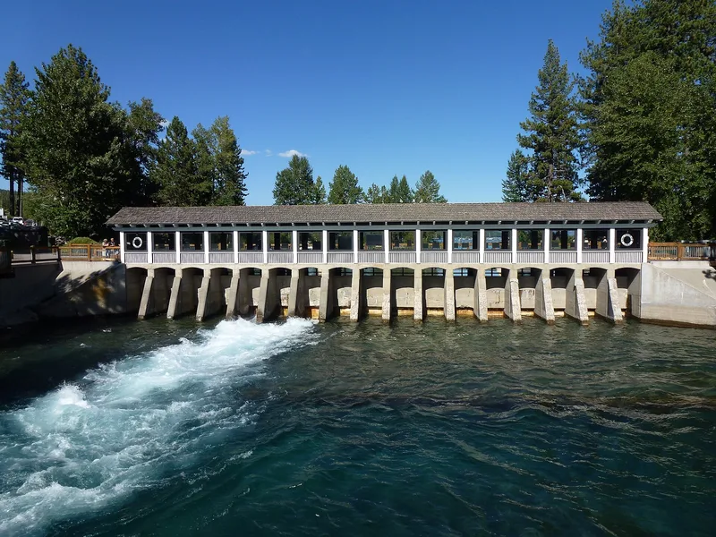
Lake Tahoe Dam is a concrete control structure at the point where Lake Tahoe flows into the Truckee River at Tahoe City, California. Built between 1909 and 1913, it is a slab-and-buttress sluiceway regulator 14 feet high and 109 feet long, with seventeen 5-by-4-foot outlet gates and a capacity of 3,000 cubic feet per second. It regulates the elevation of the lake surface and controls releases of water for irrigation and power generation. The dam is one component of the Newlands Reclamation Project, begun in 1903 and among the first efforts launched under national legislation to reclaim arid western lands for agriculture. Water stored in Lake Tahoe and Boca Reservoir is diverted from the Truckee River into the Truckee Canal and on to the Carson River system, serving almost 1,000 farms on 73,000 acres near Fallon, Nevada. The nomination treats the dam under the theme of conservation. Its proposed boundary is a 55-foot radius from the dam's center, about 0.10 acre.
Significance in brief: The nomination presents the dam under the theme of Conservation, as a component of the Newlands Reclamation Project, one of the first projects begun under national legislation to reclaim arid western lands. The dam regulates the lake's surface elevation and controls releases for irrigation and power generation.
Machine-generated summary. This summary was generated by a language model from the official nomination document and has not been reviewed line by line by an editor. It may contain errors. Check the source document before relying on any detail. Source: nomination document (PDF) · National Archives catalog entry. NRHP reference 81000713, listed March 25, 1981. Summary generated October 2026 (model claude-sonnet-5-5, prompt v1.0-2026-10-29, confidence medium).
Key facts
| Address | SR 89 at Truckee River, Tahoe City |
|---|---|
| County | Placer County |
| Listed | March 25, 1981 |
| Reference number | 81000713 |
| Resource type | Structure |
| Architectural style | Concrete slab-and-buttress sluiceway regulator |
| Areas of significance | Agriculture, Conservation, Engineering |
| Level of significance | National |
| Status (as stated in the nomination) | Condition is marked good and altered; the dam is described as still regulating lake levels and releases. |
| Acreage | 0.1 |
| Coordinates | 39.16702, -120.14492 (NPS GIS) |
What listing means for this property
For a publicly owned building or structure, listing mainly matters when federal funds, permits or licences are involved: projects then go through Section 106 review so effects on the property are considered. Listing also strengthens applications for preservation grants and, for leased income-producing uses, can enable the federal rehabilitation tax credit.
General information, not legal or tax advice. Rules change; confirm with your State Historic Preservation Office or a qualified adviser.
Sources and further reading
- National Park Service, National Register of Historic Places database (snapshot May 2026), reference 81000713.
- Nomination form (PDF, National Archives) — catalog entry
- Wikipedia article (used for cross-checking only; text not reproduced here)
- Wikidata Q6477944
- This listing as JSON
Last updated October 2026. Found an error? See the editorial policy for how to report it.