Hillcrest Park
Also known as: Reservoir Hill

Why it's listed
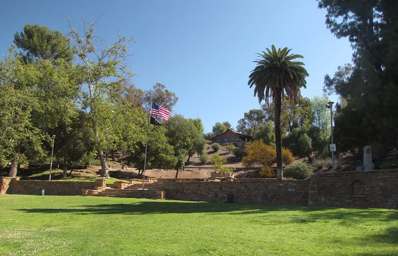
Hillcrest Park is Fullerton's largest and most historically significant park, covering 35.6 hilly acres near the city center. The city bought the land in 1920, and park superintendent Johann George Seupelt, a Bavarian-born horticulturist and landscape architect, drew up the plans. Roads and trails were laid out by mule team and plow in 1923-24, and the park was dedicated in May 1924. Between 1931 and 1941, relief workers funded by programs such as the RFC, CWA, SERA and WPA built much of its character by hand, using flagstone for stairs, walls, benches, barbecues, a bridge and a 1936 electric fountain. The park also holds the city's first reservoir, built in 1922, plus picnic areas, a turf bowl and a recreation center built as an American Legion post. It retains its original design intent, vistas and circulation, and it was designated a local landmark in 1980. The nominated area is the original acreage.
Significance in brief: The nomination presents the park as a largely intact historically designed landscape, combining formal and naturalistic areas with the city's first reservoir. It highlights the hand-built flagstone work and structures completed from 1933 to 1941 with relief-program labor, and the park's design by Seupelt, whose plans won a Southern California landscape competition in 1925.
Machine-generated summary. This summary was generated by a language model from the official nomination document and has not been reviewed line by line by an editor. It may contain errors. Check the source document before relying on any detail. Source: nomination document (PDF) · National Archives catalog entry. NRHP reference 04000812, listed August 11, 2004. Summary generated October 2026 (model claude-sonnet-5-5, prompt v1.0-2026-10-29, confidence medium).
Key facts
| Address | 200 Brea Blvd., Fullerton |
|---|---|
| County | Orange County |
| Listed | August 11, 2004 |
| Reference number | 04000812 |
| Resource type | District |
| Architect / builder | Johann George Seupelt (landscape plan); Harry F. Byerrum Sr. (roads and paths); WPA, CWA, SERA and RFC relief workers (stonework and structures) |
| Areas of significance | Entertainment/Recreation, Social History, Landscape Architecture |
| Level of significance | Local |
| Status (as stated in the nomination) | Described as in good condition with a high degree of integrity; rockwork in reasonably good condition. A master plan adopted in 1996 guides restoration and redevelopment. |
| Acreage | 35.6 |
| Coordinates | 33.88372, -117.92121 (NPS GIS) |
What listing means for this property
This is a historic district. Buildings within its boundary are either contributing (they add to the district's significance) or non-contributing. Owners of contributing income-producing buildings can claim the 20% federal rehabilitation tax credit; homeowners should look at state credits. National Register districts impose no design review by themselves; a local historic district ordinance, if one exists, does (the difference explained).
General information, not legal or tax advice. Rules change; confirm with your State Historic Preservation Office or a qualified adviser.
Sources and further reading
- National Park Service, National Register of Historic Places database (snapshot May 2026), reference 04000812.
- Nomination form (PDF, National Archives) — catalog entry
- Wikipedia article (used for cross-checking only; text not reproduced here)
- Wikidata Q111187111
- This listing as JSON
Last updated October 2026. Found an error? See the editorial policy for how to report it.