Half Dome Cables and Trail
Also known as: South Dome Cables and Trail; Tissiack Cables and Trail

Why it's listed
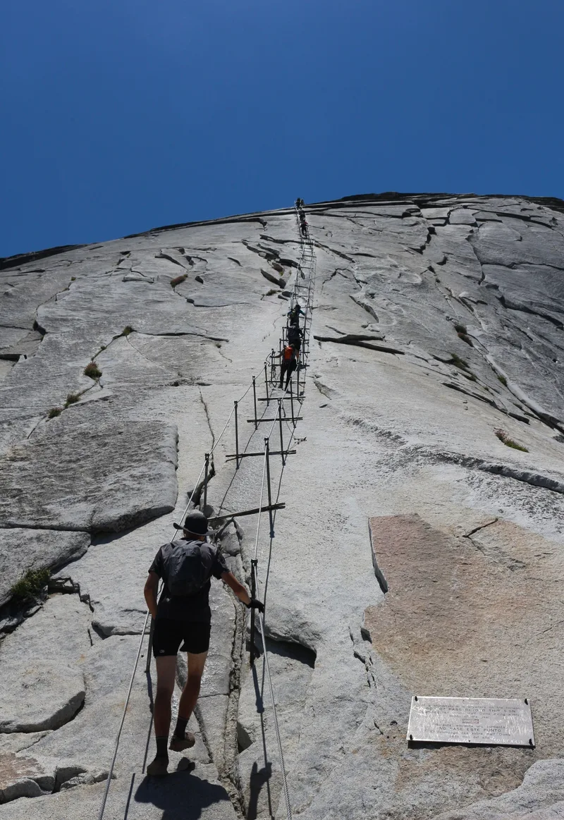
Half Dome Cables and Trail is a historic climbing route and present-day trail that climbs the eastern side of Half Dome in Yosemite National Park. It runs roughly 3,800 feet in three segments: the Sub Dome switchbacks, a saddle of exposed bedrock, and a pair of steel cables over slopes that sometimes exceed 50 degrees. George Anderson first reached the summit in 1875 using drilled holes and eyebolts. In 1919 the Sierra Club built the dry-laid granite steps and retaining walls and installed the cables. Contributing resources are the trail alignment, the stonework, and the ruins of a memorial arch honoring Anderson. The current cables and stanchions date from 1984 and are counted as non-contributing but compatible, since they follow the original design and alignment. The route is considered locally significant for recreation, transportation, its association with Anderson, and its early use of specialized climbing techniques. The period of significance runs from 1875 to 1919.
Significance in brief: The route is argued to be locally significant under Criterion A for recreation and transportation, as one of the earliest and most difficult trail projects to a high summit above Yosemite Valley. It is also tied to George Anderson, the first person to reach Half Dome's summit (Criterion B). Criterion C rests on its use of specialized rock climbing tools and techniques not previously used in U.S. climbing.
Machine-generated summary. This summary was generated by a language model from the official nomination document and has not been reviewed line by line by an editor. It may contain errors. Check the source document before relying on any detail. Source: nomination document (PDF) · National Archives catalog entry. NRHP reference 12000494, listed August 15, 2012. Summary generated October 2026 (model claude-sonnet-5-5, prompt v1.0-2026-10-29, confidence high).
Key facts
| Address | P.O. Box 577, Yosemite |
|---|---|
| County | Mariposa County |
| Listed | August 15, 2012 |
| Reference number | 12000494 |
| Resource type | District |
| Period of significance | 1875 - 1919 |
| Architect / builder | George G. Anderson; C. T. Gutleben |
| Architectural style | Other: Naturalistic Landscape Design |
| Criteria |
|
| Areas of significance | Entertainment/Recreation, Landscape Architecture |
| Level of significance | Local |
| Status (as stated in the nomination) | Described as in good condition and still a popular hiking route. The steel cables were replaced in 1934 and 1984, and the cables and stanchions are taken down each winter. |
| Acreage | 6.3 |
| Coordinates | 37.75059, -119.52811 (NPS GIS) |
What listing means for this property
This is a historic district. Buildings within its boundary are either contributing (they add to the district's significance) or non-contributing. Owners of contributing income-producing buildings can claim the 20% federal rehabilitation tax credit; homeowners should look at state credits. National Register districts impose no design review by themselves; a local historic district ordinance, if one exists, does (the difference explained).
General information, not legal or tax advice. Rules change; confirm with your State Historic Preservation Office or a qualified adviser.
Sources and further reading
- National Park Service, National Register of Historic Places database (snapshot May 2026), reference 12000494.
- Nomination form (PDF, National Archives) — catalog entry
- Wikidata Q96053096
- This listing as JSON
Last updated October 2026. Found an error? See the editorial policy for how to report it.