Aspenvale Cemetery

Why it's listed
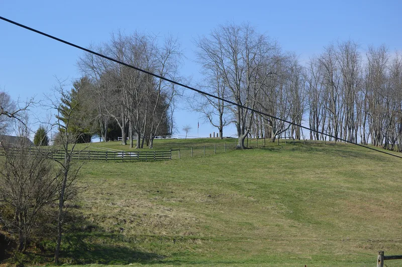
Aspenvale Cemetery occupies a steep hillside above Seven Mile Ford in Smyth County, Virginia. It is named for Aspenvale, the Campbell family home that once stood nearby. The most significant section is enclosed by a shaped limestone wall, which tradition says slave labor built, and holds 46 graves of the Preston and Campbell families. Graves of Confederate soldiers, slaves and freed blacks lie outside the wall, and a small fenced Rector family area lies to the north. Markers range from the colonial period to 1971. The cemetery is important chiefly as the burial place of General William Campbell, born in 1745, who led Virginia militia at the October 1780 victory at King's Mountain and died in 1781. His son-in-law, General Francis Preston, brought his remains here and erected a tombstone in 1823. A granite table tomb replaced the original marble in 1964 and keeps Preston's inscription.
Significance in brief: The cemetery holds the grave of General William Campbell, commander of Virginia militia at the Revolutionary War battle of King's Mountain on October 7, 1780. The form calls it the only known tangible reminder in Virginia of his contribution to American success in the war. Reviewer notes accept it under the exception for cemeteries, citing Campbell's statewide importance.
Machine-generated summary. This summary was generated by a language model from the official nomination document and has not been reviewed line by line by an editor. It may contain errors. Check the source document before relying on any detail. Source: nomination document (PDF) · National Archives catalog entry. NRHP reference 80004226, listed December 5, 1980. Summary generated October 2026 (model claude-sonnet-5-5, prompt v1.0-2026-10-29, confidence medium).
Key facts
| Address | Off U.S. 11, Seven Mile Ford |
|---|---|
| County | Smyth County |
| Listed | December 5, 1980 |
| Reference number | 80004226 |
| Resource type | Site |
| Areas of significance | Military, Exploration/Settlement |
| Level of significance | State |
| Status (as stated in the nomination) | Described as in excellent condition and unaltered, on its original site, and still occupied, with private ownership and use as a cemetery. |
| Acreage | 1 |
| Coordinates | 36.81468, -81.64001 (NPS GIS) |
What listing means for this property
Sites (archaeological sites, battlefields, landscapes) are often listed with a restricted address to protect them from looting or disturbance. Listing is honorary for private owners; federal undertakings on or near the site go through Section 106 review, and state laws may protect burials and artefacts regardless of listing.
General information, not legal or tax advice. Rules change; confirm with your State Historic Preservation Office or a qualified adviser.
Sources and further reading
- National Park Service, National Register of Historic Places database (snapshot May 2026), reference 80004226.
- Nomination form (PDF, National Archives) — catalog entry
- Wikipedia article (used for cross-checking only; text not reproduced here)
- Wikidata Q15192711
- This listing as JSON
Last updated October 2026. Found an error? See the editorial policy for how to report it.