Port Republic Historic District
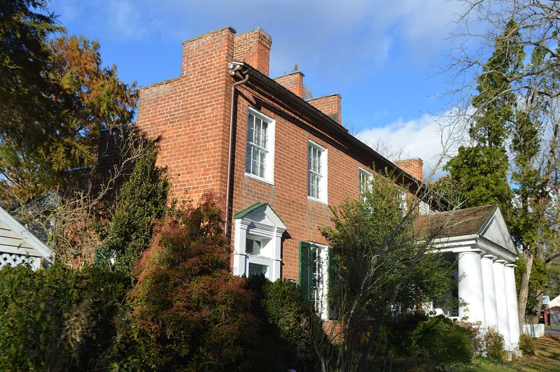

Why it's listed
Port Republic is a small village where the North and South Rivers meet to form the Shenandoah River in eastern Rockingham County. Laid out in 1802 along two parallel streets, Main and Water, it grew into an industrial and commercial center with mills, a tannery, a foundry and a flatboat-building point. As the highest navigable point on the Shenandoah, it shipped flour, iron and other upper Valley products downriver. The railroad arrived in the 1870s and reduced the town's importance, though local industry and a prosperous residential community continued. Most surviving buildings date from the late 19th and early 20th centuries, many replacing structures lost in floods of the 1870s and 1880s; a few log and brick houses are earlier. The district also includes sixty-two archaeological sites and was the scene of the Battle of Port Republic in June 1862, the last battle of Stonewall Jackson's Valley Campaign. The town retains much of its original plan and a consistent scale.
Significance in brief: The nomination presents Port Republic as a relic of the commerce on the Shenandoah River, the highest navigable point on that river. It retains much of its early town plan, buildings from several periods, and 18th-century archaeological sites. It was also the center of the June 1862 Battle of Port Republic, the last battle of Jackson's Valley Campaign.
Machine-generated summary. This summary was generated by a language model from the official nomination document and has not been reviewed line by line by an editor. It may contain errors. Check the source document before relying on any detail. Source: nomination document (PDF) · National Archives catalog entry. NRHP reference 80004224, listed September 8, 1980. Summary generated October 2026 (model claude-sonnet-5-5, prompt v1.0-2026-10-29, confidence medium).
Key facts
| Address | VA 605 and VA 865, Port Republic |
|---|---|
| County | Rockingham County |
| Listed | September 8, 1980 |
| Reference number | 80004224 |
| Resource type | District |
| Architectural style | Vernacular, with late 19th-century eclectic wooden Victorian houses and some Colonial Revival, Greek Revival and Federal details |
| Areas of significance | Industry, Community Planning and Development, Commerce, Historic - Non-Aboriginal, Military, Architecture |
| Level of significance | State |
| Status (as stated in the nomination) | Condition marked excellent and occupied; present uses include agriculture, commercial, private residence, religious and government. About 20 buildings postdate World War I and are described as not visually intrusive. |
| Acreage | 73 |
| Coordinates | 38.29262, -78.81720 (NPS GIS) |
What listing means for this property
This is a historic district. Buildings within its boundary are either contributing (they add to the district's significance) or non-contributing. Owners of contributing income-producing buildings can claim the 20% federal rehabilitation tax credit; homeowners should look at state credits. National Register districts impose no design review by themselves; a local historic district ordinance, if one exists, does (the difference explained).
General information, not legal or tax advice. Rules change; confirm with your State Historic Preservation Office or a qualified adviser.
Sources and further reading
- National Park Service, National Register of Historic Places database (snapshot May 2026), reference 80004224.
- Nomination form (PDF, National Archives) — catalog entry
- Wikipedia article (used for cross-checking only; text not reproduced here)
- Wikidata Q15267589
- This listing as JSON
Last updated October 2026. Found an error? See the editorial policy for how to report it.