Echols Farm
Also known as: 81-5012; 44rb216; 44rb217

Why it's listed
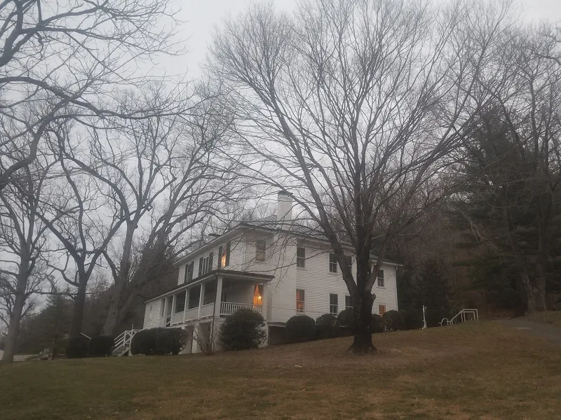
Echols Farm occupies about 253 acres on the Maury River across from Glasgow, Virginia, near where the Maury meets the James at Balcony Falls. Edward Echols bought the land in the early 1850s and built a one-and-one-half story frame house and a warehouse beside the new canal. He worked as a canal boat operator, lock-keeper and merchant, and began mining iron ore on the mountain behind the house in 1859. Two granite canal locks, the canal trace and the warehouse foundation survive from that era. The house was enlarged about 1914 to two stories with a hipped roof and wraparound porch. Early twentieth-century outbuildings include a brick tenant house, springhouse, corncrib and equipment shed. The property is recognized for its ties to canal transportation, commerce, industry, agriculture and architecture between about 1855 and 1948, and it has remained a family seat for the Echols descendants.
Significance in brief: The farm is argued to be significant under Criteria A and C for its link to the James River and Kanawha Canal, where Edward Echols ran locks, canal boats and a warehouse, and to his iron mining. It also represents a typical mid-19th century canal-side farmstead that was later enlarged in 1914 and continued as the Echols family seat.
Machine-generated summary. This summary was generated by a language model from the official nomination document and has not been reviewed line by line by an editor. It may contain errors. Check the source document before relying on any detail. Source: nomination document (PDF) · National Archives catalog entry. NRHP reference 98001312, listed October 30, 1998. Summary generated October 2026 (model claude-sonnet-5-5, prompt v1.0-2026-10-29, confidence high).
Key facts
| Address | Jct. of VA 130 and 501, Glasgow |
|---|---|
| County | Rockbridge County |
| Listed | October 30, 1998 |
| Reference number | 98001312 |
| Resource type | Building |
| Period of significance | 1855 ca. to 1948 |
| Architectural style | Other (vernacular frame farmhouse) |
| Criteria |
|
| Areas of significance | Transportation, Commerce, Architecture, Industry, Agriculture, Engineering |
| Level of significance | Local |
| Status (as stated in the nomination) | Still an operating farm and family gathering place and vacation home; the house is in use as a dwelling. Road traffic and river bank erosion are described as threats. |
| Acreage | 253 |
| Coordinates | 37.63081, -79.44051 (NPS GIS) |
What listing means for this property
National Register listing is honorary for a privately owned home: it does not by itself restrict what an owner may do with their own money, and it does not require public access. Restrictions come from local landmark or historic-district ordinances, which are separate (how they differ).
Owner-occupied houses are not eligible for the 20% federal rehabilitation tax credit, which applies to income-producing buildings, but many states offer credits for homeowners. Listing also opens the door to preservation easements and to buying a plaque. Start with what listing means for homeowners, renovating a listed house and selling one.
General information, not legal or tax advice. Rules change; confirm with your State Historic Preservation Office or a qualified adviser.
Sources and further reading
- National Park Service, National Register of Historic Places database (snapshot May 2026), reference 98001312.
- Nomination form (PDF, National Archives) — catalog entry
- Wikipedia article (used for cross-checking only; text not reproduced here)
- Wikidata Q15216036
- This listing as JSON
Last updated October 2026. Found an error? See the editorial policy for how to report it.