Sunnyside
Also known as: Sunnyside Farms; DHR Id # 078-0049

Why it's listed
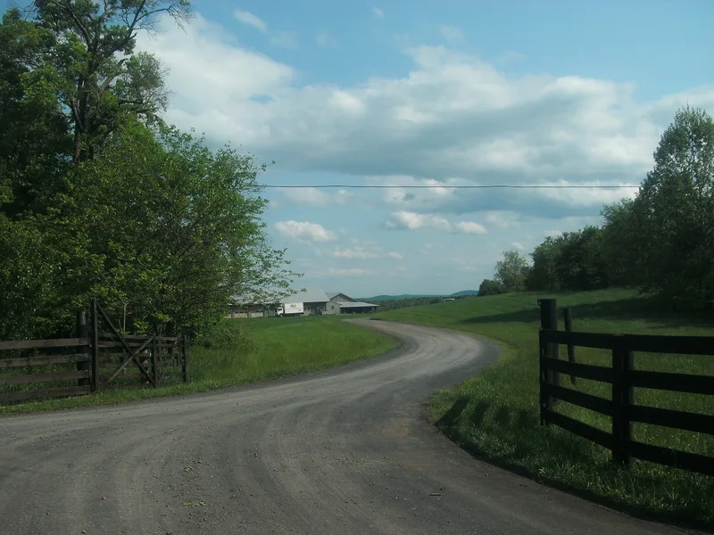
Sunnyside is a 421-acre farm district near Washington, Virginia, in Rappahannock County, set in a hollow beside Fodder Stack Mountain and Shenandoah National Park. Its main house began as a two-story log dwelling around 1785, gained a stone kitchen wing about 1800, a frame wing around 1850, and further additions in 1940 and 1996. Around it stand secondary dwellings, a stone slave quarters, smokehouses, a springhouse, a root cellar, a family cemetery and modern farm buildings. The property was bought by Henry Miller in 1780 and stayed with his descendants, including the Wood family, until 1996. Its main importance lies in agriculture: Charles Burrell Wood planted the first commercial apple orchard in the county here in 1873, and seedlings from his trees supplied later orchards. Sunnyside remains a commercial orchard today, with apples, peaches, vegetables and pasture. Its collection of farm buildings also records how a working farm adapted over time.
Significance in brief: It is the site of the first commercial apple orchard in Rappahannock County, planted by Charles Burrell Wood in 1873, and has operated as a commercial orchard continuously since. It is also significant as a well-preserved collection of domestic and agricultural buildings dating from circa 1785 to 1954.
Machine-generated summary. This summary was generated by a language model from the official nomination document and has not been reviewed line by line by an editor. It may contain errors. Check the source document before relying on any detail. Source: nomination document (PDF) · National Archives catalog entry. NRHP reference 04001274, listed November 27, 2004. Summary generated October 2026 (model claude-sonnet-5-5, prompt v1.0-2026-10-29, confidence medium).
Key facts
| Address | 186 Sunnyside Orchard Ln., Washington |
|---|---|
| County | Rappahannock County |
| Listed | November 27, 2004 |
| Reference number | 04001274 |
| Resource type | District |
| Period of significance | circa 1785-1954 |
| Architectural style | Other: Log House |
| Criteria |
|
| Areas of significance | Agriculture, Architecture |
| Level of significance | Local |
| Status (as stated in the nomination) | Continues as a working commercial orchard and farm with vegetables, pasture, apple and peach trees; the main house and outbuildings remain in domestic and agricultural use. |
| Acreage | 421.9 |
| Coordinates | 38.74064, -78.15950 (NPS GIS) |
What listing means for this property
This is a historic district. Buildings within its boundary are either contributing (they add to the district's significance) or non-contributing. Owners of contributing income-producing buildings can claim the 20% federal rehabilitation tax credit; homeowners should look at state credits. National Register districts impose no design review by themselves; a local historic district ordinance, if one exists, does (the difference explained).
General information, not legal or tax advice. Rules change; confirm with your State Historic Preservation Office or a qualified adviser.
Sources and further reading
- National Park Service, National Register of Historic Places database (snapshot May 2026), reference 04001274.
- Nomination form (PDF, National Archives) — catalog entry
- Wikipedia article (used for cross-checking only; text not reproduced here)
- Wikidata Q16900922
- This listing as JSON
Last updated October 2026. Found an error? See the editorial policy for how to report it.