Flint Hill Historic District
Also known as: DHR File Number: 078-5018
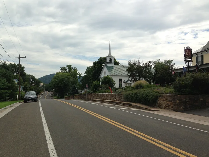

Why it's listed
Flint Hill is a small linear village in northern Rappahannock County, Virginia, strung along Zachary Taylor Highway (U.S. Route 522) at a crossroads with Fodderstack, Crest Hill and Ben Venue Roads. The historic district covers 115.6 acres and holds 127 contributing resources, including houses, shops, churches, cemeteries, a school and farm outbuildings, set within a rural landscape with views of the Blue Ridge. Settlement began around 1742 with a tanyard, blacksmith and wheelwright shops and a log tavern, and the village was formally established in 1843. The oldest surviving building is the log section of Althea Terrace, later updated in the Greek Revival style. Other buildings show Federal, Italianate, Craftsman and Colonial Revival influences, often applied to older vernacular houses as the village prospered, notably through orchards. Listing recognizes the village's commercial and transportation role and its architecture, spanning roughly 1742 to 1950.
Significance in brief: The district is significant for its role in commerce, exploration/settlement, transportation and architecture. It grew from a mid-18th-century crossroads community with a tavern and craft shops into a village formally established in 1843. Its buildings show vernacular traditions alongside Federal, Greek Revival, Italianate, Bungalow/Craftsman and Colonial Revival detailing.
Machine-generated summary. This summary was generated by a language model from the official nomination document and has not been reviewed line by line by an editor. It may contain errors. Check the source document before relying on any detail. Source: nomination document (PDF) · National Archives catalog entry. NRHP reference 11001070, listed January 27, 2012. Summary generated October 2026 (model claude-sonnet-5-5, prompt v1.0-2026-10-29, confidence medium).
Key facts
| Address | Jct. of US 522, Fodderstack, Crest Hill, & Ben Venue Rds., Flint Hill |
|---|---|
| County | Rappahannock County |
| Listed | January 27, 2012 |
| Reference number | 11001070 |
| Resource type | Building |
| Period of significance | circa 1742 - circa 1950 |
| Architectural style | Federal; Greek Revival; Gothic Revival; Italianate; Colonial Revival; Classical Revival; Tudor Revival; Bungalow/Craftsman (mostly vernacular interpretations) |
| Criteria |
|
| Areas of significance | Architecture, Community Planning and Development, Commerce, Exploration/Settlement, Transportation |
| Level of significance | Local |
| Status (as stated in the nomination) | Many buildings remain in use as dwellings, shops, a post office, schools and churches; some have been altered, and later infill includes a 1987 bank. |
| Acreage | 115.6 |
| Coordinates | 38.76896, -78.09979 (NPS GIS) |
What listing means for this property
National Register listing is honorary: it recognises significance and does not restrict what a private owner may do without federal money or permits. It unlocks the 20% federal rehabilitation tax credit for income-producing buildings, state credits in many states, and Section 106 review when federal agencies are involved. See what listing means in practice.
General information, not legal or tax advice. Rules change; confirm with your State Historic Preservation Office or a qualified adviser.
Sources and further reading
- National Park Service, National Register of Historic Places database (snapshot May 2026), reference 11001070.
- Nomination form (PDF, National Archives) — catalog entry
- Wikipedia article (used for cross-checking only; text not reproduced here)
- Wikidata Q5459517
- This listing as JSON
Last updated October 2026. Found an error? See the editorial policy for how to report it.