Thoroughfare Gap Battlefield
Also known as: DHR File No. 30-1016

Why it's listed
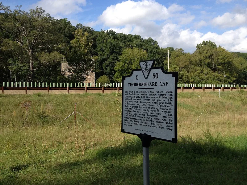
Thoroughfare Gap is a narrow pass through the Bull Run Mountains on the line between Prince William and Fauquier counties, Virginia, long used as a protected route between Northern Virginia and the Shenandoah Valley. On August 28, 1862, Confederate and Union forces fought here as Robert E. Lee and James Longstreet tried to pass through and reunite with Stonewall Jackson ahead of the Second Battle of Manassas. Confederate troops held the high ground on both sides of the Gap and sent a brigade over the mountain to turn the Union flank, forcing Union troops to retreat. The battlefield took in two stone gristmills, the Chapman house known as Meadowland, an ice pit, a family cemetery, a long quarry trench, a millrace and the Manassas Gap Railroad. Several of these now stand as ruins, but the landscape has changed little apart from Interstate 66 and denser tree cover. The Gap was also an early example of military use of a railroad.
Significance in brief: The August 28, 1862 Battle of Thoroughfare Gap let Confederate forces under Lee and Longstreet pass through the mountains to rejoin Jackson before the Second Battle of Manassas. The Gap was also an early strategic use of rail for military movement. Many of the resources present during the fighting survive and keep a high degree of integrity.
Machine-generated summary. This summary was generated by a language model from the official nomination document and has not been reviewed line by line by an editor. It may contain errors. Check the source document before relying on any detail. Source: nomination document (PDF) · National Archives catalog entry. NRHP reference 99001374, listed November 18, 1999. Summary generated October 2026 (model claude-sonnet-5-5, prompt v1.0-2026-10-29, confidence high).
Key facts
| Address | Jct. VA 55 and I-66, Broad Run |
|---|---|
| County | Prince William County |
| Listed | November 18, 1999 |
| Reference number | 99001374 |
| Resource type | Site |
| Period of significance | 1861-1865 |
| Architect / builder | Unknown |
| Criteria |
|
| Areas of significance | Military |
| Level of significance | National |
| Status (as stated in the nomination) | Many historic buildings are ruins and the landscape is now largely wooded. Several noncontributing buildings are described as abandoned. Current function listed includes outdoor recreation, conservation area and vacant/not in use. |
| Acreage | 514 |
| Coordinates | 38.82320, -77.71147 (NPS GIS) |
What listing means for this property
Sites (archaeological sites, battlefields, landscapes) are often listed with a restricted address to protect them from looting or disturbance. Listing is honorary for private owners; federal undertakings on or near the site go through Section 106 review, and state laws may protect burials and artefacts regardless of listing.
General information, not legal or tax advice. Rules change; confirm with your State Historic Preservation Office or a qualified adviser.
Sources and further reading
- National Park Service, National Register of Historic Places database (snapshot May 2026), reference 99001374.
- Nomination form (PDF, National Archives) — catalog entry
- Wikipedia article (used for cross-checking only; text not reproduced here)
- Wikidata Q16901611
- This listing as JSON
Last updated October 2026. Found an error? See the editorial policy for how to report it.