Beverley Mill
Also known as: Chapman Mill

Why it's listed
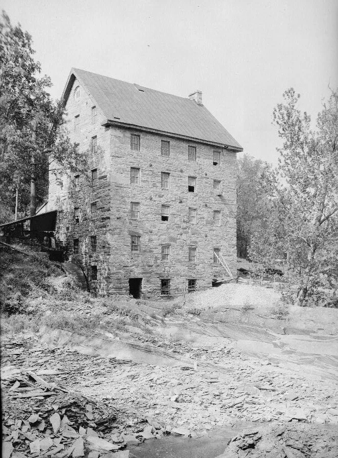
Beverley Mill is a five-story stone mill with an additional attic story, set on the lower slopes of Thoroughfare Gap near The Plains in Prince William County. Built of partly coursed rubble stone quarried from the creek and mountainside, it has four bays on the main front and six-over-six windows. A 29-foot metal waterwheel, sluice gate and stone mill race survive outside. The mill predates 1759, when official records used it as a boundary marker between Prince William and the newly created Fauquier County. Jonathan Chapman, who bought the Broad Run property in 1742, built the grist mill and a flour mill that has since been destroyed. Two stories were added in the 1850s. The mill supplied food during several wars and was modernized in 1900 and the 1940s, when it ground about 100,000 bushels of grain a year. It operated through World War II. Interstate 66 was redesigned to bypass it after citizen and government effort.
Significance in brief: The mill is mentioned in 1759 records as a boundary marker between Prince William and the new Fauquier County. It supplied food products during five wars, from the French and Indian War through the Civil War, and operated through World War II. Its preservation led highway officials to redesign Interstate 66 to bypass it.
Machine-generated summary. This summary was generated by a language model from the official nomination document and has not been reviewed line by line by an editor. It may contain errors. Check the source document before relying on any detail. Source: nomination document (PDF) · National Archives catalog entry. NRHP reference 72001411, listed February 23, 1972. Summary generated October 2026 (model claude-sonnet-5-5, prompt v1.0-2026-10-29, confidence medium).
Key facts
| Address | Jct. of VA 600 and 55, Plains |
|---|---|
| County | Prince William County |
| Listed | February 23, 1972 |
| Reference number | 72001411 |
| Resource type | Building |
| Architect / builder | Jonathan Chapman (built the grist mill and a since-destroyed flour mill) |
| Areas of significance | Industry, Military, Agriculture |
| Level of significance | State |
| Status (as stated in the nomination) | Listed as unoccupied and vacant, in fair condition; the interior was inaccessible at the time of nomination. No longer in use as a mill. |
| Acreage | 9.9 |
| Coordinates | 38.82457, -77.71044 (NPS GIS) |
What listing means for this property
For an income-producing building, listing (individually or as a contributing building in a district) is the gateway to the 20% federal rehabilitation tax credit on qualified rehabilitation costs, often stackable with state credits. Work claiming the credit must follow the Secretary of the Interior's Standards and be approved in advance.
Listing does not restrict a private owner acting without federal money or permits; where federal funding or licensing is involved, Section 106 review applies.
Noted as vacant in the nomination. Nomination documents can be decades old; current status may differ. If you are considering buying an empty listed property, read the due-diligence checklist.
General information, not legal or tax advice. Rules change; confirm with your State Historic Preservation Office or a qualified adviser.
Sources and further reading
- National Park Service, National Register of Historic Places database (snapshot May 2026), reference 72001411.
- Nomination form (PDF, National Archives) — catalog entry
- Wikipedia article (used for cross-checking only; text not reproduced here)
- Wikidata Q15198774
- This listing as JSON
Last updated October 2026. Found an error? See the editorial policy for how to report it.