Somerset

Why it's listed
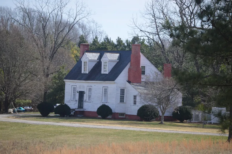
Somerset is a frame farmhouse on a rural farm in western Powhatan County, Virginia. It probably began around 1775 as a one-story, one-room house with a rear shed and a full brick basement, then grew in two later phases. Today it is a one-and-a-half-story hall-chamber house with a lean-to across the rear, four exterior brick chimneys, a slate roof and beaded weatherboard siding. Inside, Federal-style mantels, two-part architrave trim and wainscot reflect extensive early nineteenth-century remodeling, while the basement, floor framing and roof structure preserve evidence of the earliest building, including a large brick chimney base from an original interior chimney. The land was bought in 1774 by Elizabeth McLaurine, widow of the Rev. Robert McLaurine, and the house was likely built for her and her young family. Her relatives included sons who served in the Revolutionary era, and a grandson was Confederate figure John Singleton Mosby. The property also includes a cemetery and farm outbuildings.
Significance in brief: The house is significant as an architectural resource with a complex, readable construction history, where the framing, foundation and interior finishes record three phases of change. It is also tied to the McLaurine family, who acquired the tract in 1774 and built the house for the widow Elizabeth McLaurine. The family's later ties include the Confederate figure John Singleton Mosby.
Machine-generated summary. This summary was generated by a language model from the official nomination document and has not been reviewed line by line by an editor. It may contain errors. Check the source document before relying on any detail. Source: nomination document (PDF) · National Archives catalog entry. NRHP reference 06000804, listed September 6, 2006. Summary generated October 2026 (model claude-sonnet-5-5, prompt v1.0-2026-10-29, confidence medium).
Key facts
| Address | 2310 Ballsville Rd., Powhatan |
|---|---|
| County | Powhatan County |
| Listed | September 6, 2006 |
| Reference number | 06000804 |
| Resource type | Building |
| Architectural style | Colonial: Georgian; Early Republic: Federal |
| Areas of significance | Architecture |
| Level of significance | Local |
| Status (as stated in the nomination) | Current function listed as single dwelling and cemetery, with the house also marked vacant/not in use. |
| Acreage | 20 |
| Coordinates | 37.54907, -78.08794 (NPS GIS) |
What listing means for this property
National Register listing is honorary: it recognises significance and does not restrict what a private owner may do without federal money or permits. It unlocks the 20% federal rehabilitation tax credit for income-producing buildings, state credits in many states, and Section 106 review when federal agencies are involved. See what listing means in practice.
Noted as vacant in the nomination. Nomination documents can be decades old; current status may differ. If you are considering buying an empty listed property, read the due-diligence checklist.
General information, not legal or tax advice. Rules change; confirm with your State Historic Preservation Office or a qualified adviser.
Sources and further reading
- National Park Service, National Register of Historic Places database (snapshot May 2026), reference 06000804.
- Nomination form (PDF, National Archives) — catalog entry
- Wikipedia article (used for cross-checking only; text not reproduced here)
- Wikidata Q15278492
- This listing as JSON
Last updated October 2026. Found an error? See the editorial policy for how to report it.