Milford Battlefield
Also known as: DHR File No. 93-5023

Why it's listed
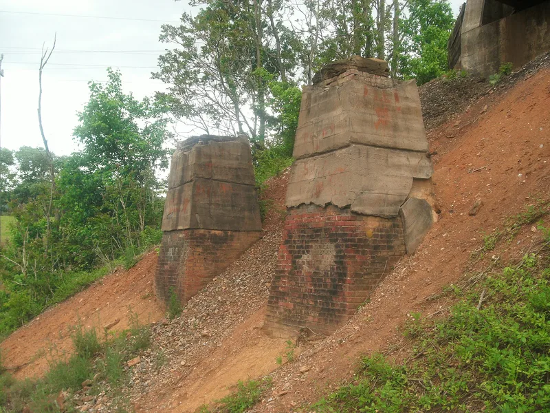
Milford Battlefield covers about 700 acres of hilly ground in Page and Warren Counties, Virginia, between the South Fork of the Shenandoah River and the Blue Ridge. The Page Valley narrows here, and Overall Run's deep ravine made the spot the most easily defended position in the valley. The district contains 16 contributing resources, including the Overall House ruin, a historic cemetery, a turnpike bridge abutment, the old Luray and Front Royal Turnpike, and Confederate earthworks and rifle pits. Many later houses, sheds and barns are noncontributing but do not hide how the fighting unfolded. Troops skirmished here in June 1862 and in 1864. The most important engagement came on September 22, 1864, after Sheridan defeated Early at Winchester. Confederate cavalry under Wickham entrenched south of Milford to block Union cavalry led by Merritt, Wilson and Custer. The site was listed for its association with these Civil War events.
Significance in brief: The nomination ties the property to Civil War cavalry engagements at Milford in 1862 and 1864, especially the September 22, 1864 fight after Sheridan's victory at Third Winchester. Confederate cavalry under Wickham held fortified ground here to guard the Page Valley against a Union flanking move. The terrain and surviving earthworks still allow the course of the fighting to be understood.
Machine-generated summary. This summary was generated by a language model from the official nomination document and has not been reviewed line by line by an editor. It may contain errors. Check the source document before relying on any detail. Source: nomination document (PDF) · National Archives catalog entry. NRHP reference 04000854, listed August 11, 2004. Summary generated October 2026 (model claude-sonnet-5-5, prompt v1.0-2026-10-29, confidence medium).
Key facts
| Address | VA 340 and VA 665, Overall |
|---|---|
| County | Page County |
| Listed | August 11, 2004 |
| Reference number | 04000854 |
| Resource type | District |
| Architectural style | Mid-19th Century |
| Criteria |
|
| Areas of significance | Military |
| Level of significance | Local |
| Status (as stated in the nomination) | Mostly wooded land with scattered, mostly noncontributing 20th-century houses and outbuildings; the Overall House is a ruin; a highway and railroad cross the site. |
| Acreage | 700 |
| Coordinates | 38.80742, -78.34254 (NPS GIS) |
What listing means for this property
This is a historic district. Buildings within its boundary are either contributing (they add to the district's significance) or non-contributing. Owners of contributing income-producing buildings can claim the 20% federal rehabilitation tax credit; homeowners should look at state credits. National Register districts impose no design review by themselves; a local historic district ordinance, if one exists, does (the difference explained).
General information, not legal or tax advice. Rules change; confirm with your State Historic Preservation Office or a qualified adviser.
Sources and further reading
- National Park Service, National Register of Historic Places database (snapshot May 2026), reference 04000854.
- Nomination form (PDF, National Archives) — catalog entry
- Wikipedia article (used for cross-checking only; text not reproduced here)
- Wikidata Q6851713
- This listing as JSON
Last updated October 2026. Found an error? See the editorial policy for how to report it.