Fort Crafford

Why it's listed
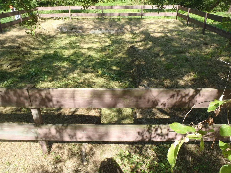
Fort Crafford is a pentagon-shaped earthwork on Mulberry Island Point, inside the Fort Eustis military reservation in Newport News, Virginia. Confederate forces built it in the summer of 1861 at General Lee's order. It anchored the James River end of General Magruder's line across the Peninsula from Yorktown. Working with another fort across the river and a fleet of gunboats, it helped control Union shipping and guarded against a landing on the Confederate right flank. Magruder's thin line delayed McClellan's advance for a month in the spring of 1862, giving Confederate troops time to prepare Richmond's defense. The works were abandoned on 3 May 1862. The site holds an outer wall, a moat, a high inner wall, gun emplacements, family graveyards and the foundation of the Crafford colonial house. The land was also tied to Jamestown's 1610 rescue and to the Crafford ferry of 1749.
Significance in brief: The fort was built at General Lee's order as the James River anchor of General Magruder's Peninsula defensive line. With a nearby fort and the James River gunboat fleet, it controlled Union shipping and protected the Confederate right flank during the 1862 Peninsular Campaign. The line delayed McClellan about a month, giving the Confederates time to defend Richmond. The site also has earlier links to the 1610 Jamestown colonists and the 1749 Crafford homestead.
Machine-generated summary. This summary was generated by a language model from the official nomination document and has not been reviewed line by line by an editor. It may contain errors. Check the source document before relying on any detail. Source: nomination document (PDF) · National Archives catalog entry. NRHP reference 74002237, listed May 17, 1974. Summary generated October 2026 (model claude-sonnet-5-5, prompt v1.0-2026-10-29, confidence medium).
Key facts
| Address | Fort Eustis Military Reservation on Mulberry Island Point, Newport News (Independent City) |
|---|---|
| County | Newport News |
| Listed | May 17, 1974 |
| Reference number | 74002237 |
| Resource type | Building |
| Period of significance | 1861-1862 |
| Areas of significance | Military |
| Level of significance | State |
| Status (as stated in the nomination) | Described as remarkably well preserved and in good condition; the timber-framed magazines and shelters have collapsed and are covered by vegetation. The form marks it as unoccupied, with restricted public access, on a military reservation. |
| Acreage | 9.5 |
| Coordinates | 37.12847, -76.61779 (NPS GIS) |
What listing means for this property
National Register listing is honorary: it recognises significance and does not restrict what a private owner may do without federal money or permits. It unlocks the 20% federal rehabilitation tax credit for income-producing buildings, state credits in many states, and Section 106 review when federal agencies are involved. See what listing means in practice.
General information, not legal or tax advice. Rules change; confirm with your State Historic Preservation Office or a qualified adviser.
Sources and further reading
- National Park Service, National Register of Historic Places database (snapshot May 2026), reference 74002237.
- Nomination form (PDF, National Archives) — catalog entry
- Wikipedia article (used for cross-checking only; text not reproduced here)
- Wikidata Q16891375
- This listing as JSON
Last updated October 2026. Found an error? See the editorial policy for how to report it.