Fort Huger
Also known as: VDHR File 046-0037; Sites 44IW0065 & 44iw0204

Why it's listed
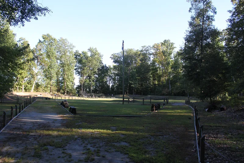
Fort Huger is a Civil War earthwork on Hardy's Bluff, overlooking the James River near Smithfield in Isle of Wight County. Confederate forces built it in 1861 under State Engineer Andrew Talcott as the south flank strongpoint of General Magruder's defensive line. A Union officer's 1862 survey described a bastioned work with a deep ditch, sod-faced parapets and twelve guns. The listed site covers about 22 acres and includes the fort, the remains of a hot shot furnace and a nearby winter encampment, where as many as 40 huts may have housed over 150 men. Mapped incorrectly in 1977, the fort was rediscovered during surveys beginning in 2004, and the developers deeded the land to the county. Excavations show good subsurface preservation of the furnace foundation and the camp. The property was recognized for its role in early Civil War defense of the James River and for its archaeological potential.
Significance in brief: The nomination argues the fort was an integral part of the Confederate James River defenses in 1861-1862, anchoring the south flank of General Magruder's line. It is described as largely intact and unaffected by modern development. It is also expected to yield archaeological information about the fort's structures and the soldiers who wintered there.
Machine-generated summary. This summary was generated by a language model from the official nomination document and has not been reviewed line by line by an editor. It may contain errors. Check the source document before relying on any detail. Source: nomination document (PDF) · National Archives catalog entry. NRHP reference 08000320, listed April 16, 2008. Summary generated October 2026 (model claude-sonnet-5-5, prompt v1.0-2026-10-29, confidence medium).
Key facts
| Address | Talcott Terrace, Smithfield |
|---|---|
| County | Isle of Wight County |
| Listed | April 16, 2008 |
| Reference number | 08000320 |
| Resource type | Site |
| Period of significance | 1861-1862 |
| Architect / builder | N/A (construction directed by State Engineer Andrew Talcott, per the narrative) |
| Architectural style | No Style |
| Criteria |
|
| Areas of significance | Military, Historic - Non-Aboriginal |
| Level of significance | State |
| Status (as stated in the nomination) | Abandoned Civil War fort now county-owned and being prepared as an interpretive park with a parking area, pathway and signage; archaeological work is ongoing. |
| Acreage | 22 |
| Coordinates | 37.10966, -76.65874 (NPS GIS) |
What listing means for this property
Sites (archaeological sites, battlefields, landscapes) are often listed with a restricted address to protect them from looting or disturbance. Listing is honorary for private owners; federal undertakings on or near the site go through Section 106 review, and state laws may protect burials and artefacts regardless of listing.
General information, not legal or tax advice. Rules change; confirm with your State Historic Preservation Office or a qualified adviser.
Sources and further reading
- National Park Service, National Register of Historic Places database (snapshot May 2026), reference 08000320.
- Nomination form (PDF, National Archives) — catalog entry
- Wikipedia article (used for cross-checking only; text not reproduced here)
- Wikidata Q14712328
- This listing as JSON
Last updated October 2026. Found an error? See the editorial policy for how to report it.