Hibbs Bridge
Also known as: Beaverdam Bridge; Snickersville Turnpike Bridge; Bridge # 6088; VDHR File No. 0530243

Why it's listed
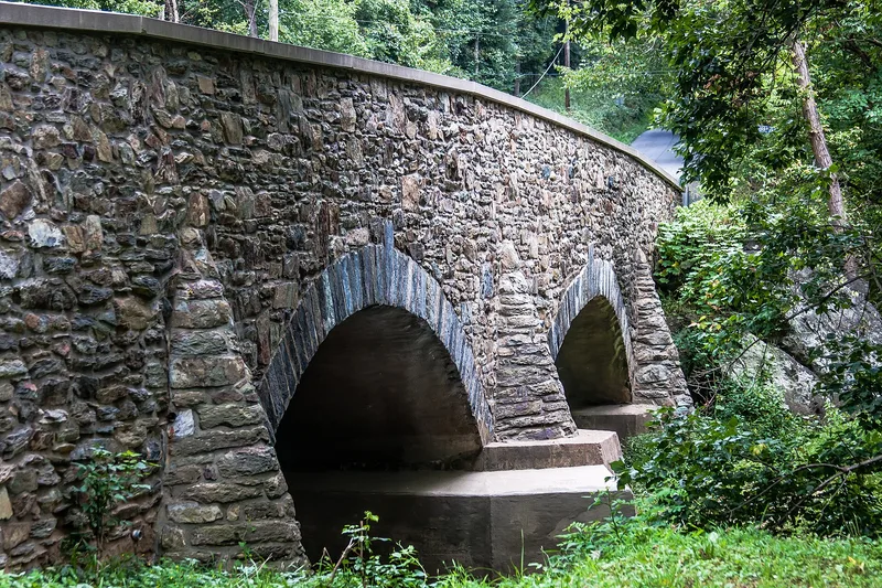
Hibbs Bridge carries Snickersville Pike over Beaverdam Creek in southern Loudoun County, Virginia. Built in 1829 by Uriel Glasscock for the Snickers Gap Turnpike Company, it has two segmental arches, conical buttresses, and fieldstone walls, with cut-stone voussoirs and keystones. It is about 125 feet long and 25 feet wide, and the roadbed rises toward the center. The turnpike company turned to stone after floods destroyed earlier wooden bridges in the area. Glasscock was reportedly paid $3,500 for the work. The bridge is one of few surviving stone-arch turnpike bridges in Virginia and the third oldest in Loudoun County. Its name changed from Beaverdam Bridge after the Hibbs family acquired the surrounding land. The turnpike company gave up the bridge to the county in 1869. Concrete scour aprons and coping were added in the twentieth century, and a 2007-2008 rehabilitation repaired the masonry and installed a reinforced concrete deck. It remains in daily use.
Significance in brief: The nomination argues statewide significance under Criterion A in transportation, through its link to the Snickers Gap Turnpike, one of the earliest turnpikes in Virginia. It is also a rare survivor of a stone-arch bridge type uncommon on Virginia turnpikes, and the third oldest in Loudoun County. The period of significance ends in 1869, when the turnpike company released the bridge to Loudoun County.
Machine-generated summary. This summary was generated by a language model from the official nomination document and has not been reviewed line by line by an editor. It may contain errors. Check the source document before relying on any detail. Source: nomination document (PDF) · National Archives catalog entry. NRHP reference 11000067, listed March 1, 2011. Summary generated October 2026 (model claude-sonnet-5-5, prompt v1.0-2026-10-29, confidence high).
Key facts
| Address | SR 734 6 mi NW of Aldie between Hibbs Bridge Rd (SR 731 W) to the S and Watermill Rd (SR 731 E) to the N, Mountville |
|---|---|
| County | Loudoun County |
| Listed | March 1, 2011 |
| Reference number | 11000067 |
| Resource type | Structure |
| Period of significance | 1829-1869 |
| Architect / builder | Uriel Glasscock |
| Architectural style | OTHER: Stone-arch bridge |
| Criteria |
|
| Areas of significance | Transportation |
| Level of significance | Local |
| Status (as stated in the nomination) | Open to vehicular traffic and owned and maintained by the Virginia Department of Transportation; rehabilitated in 2007-2008 and reopened in 2008. |
| Acreage | 0.9 |
| Coordinates | 39.03761, -77.72277 (NPS GIS) |
What listing means for this property
For a publicly owned building or structure, listing mainly matters when federal funds, permits or licences are involved: projects then go through Section 106 review so effects on the property are considered. Listing also strengthens applications for preservation grants and, for leased income-producing uses, can enable the federal rehabilitation tax credit.
General information, not legal or tax advice. Rules change; confirm with your State Historic Preservation Office or a qualified adviser.
Sources and further reading
- National Park Service, National Register of Historic Places database (snapshot May 2026), reference 11000067.
- Nomination form (PDF, National Archives) — catalog entry
- Wikidata Q115287933
- This listing as JSON
Last updated October 2026. Found an error? See the editorial policy for how to report it.