Goose Creek Historic District

Why it's listed
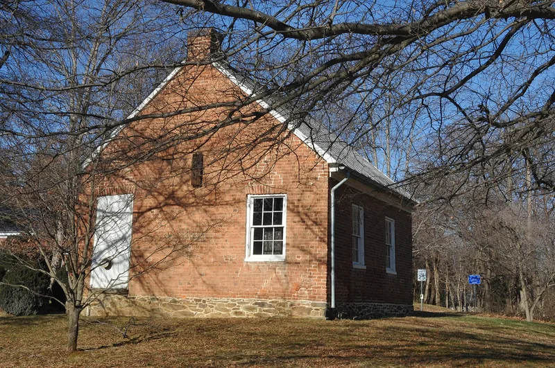
Goose Creek Historic District covers roughly 8,650 acres of farmland in central Loudoun County, Virginia, between Hogback Mountain and Black Oak Ridge. The village of Lincoln is its hub. English Quakers began settling the area in the 1730s, and it became the largest concentration of Quaker settlers in the state. They favored wheat and other grains on small farms worked by free labor, and many farms still follow the boundaries of 18th-century land patents. The district holds farmhouses, barns, meetinghouses, churches and schools in stone, brick, log and frame. About forty-four stone buildings, including seven barns and three churches, form the largest concentration of stone architecture in the county. Narrow, winding dirt roads laid out in the 18th century are largely unchanged. Quaker and Baptist churches, Lincoln's black churches of the 1880s, and an 1815 schoolhouse show the community's religious and educational life. A local preservation ordinance now protects the farmland and its scenery.
Significance in brief: The district held the largest concentration of Quaker settlers in Virginia, who began arriving in the 1730s and shaped a society of small grain farms worked by free labor. It is also significant for its collection of vernacular architecture, especially fieldstone masonry, and for a landscape that keeps its early land patents, roads and barns.
Machine-generated summary. This summary was generated by a language model from the official nomination document and has not been reviewed line by line by an editor. It may contain errors. Check the source document before relying on any detail. Source: nomination document (PDF) · National Archives catalog entry. NRHP reference 82001822, listed November 14, 1982. Summary generated October 2026 (model claude-sonnet-5-5, prompt v1.0-2026-10-29, confidence medium).
Key facts
| Address | Roughly bounded by Purcellville, VA 611, 728, 797, 622, 704, and 709, Lincoln |
|---|---|
| County | Loudoun County |
| Listed | November 14, 1982 |
| Reference number | 82001822 |
| Resource type | District |
| Period of significance | various |
| Architectural style | Rural vernacular architecture in stone, brick, log and frame, with Federal and Greek Revival examples |
| Areas of significance | Commerce, Exploration/Settlement, Architecture, Religion, Agriculture |
| Level of significance | State |
| Status (as stated in the nomination) | Remains a predominantly agricultural area; a local preservation ordinance protects its agricultural use and scenic integrity, and many historic structures have been restored. |
| Acreage | 865 |
| Coordinates | 39.08131, -77.67499 (NPS GIS) |
What listing means for this property
This is a historic district. Buildings within its boundary are either contributing (they add to the district's significance) or non-contributing. Owners of contributing income-producing buildings can claim the 20% federal rehabilitation tax credit; homeowners should look at state credits. National Register districts impose no design review by themselves; a local historic district ordinance, if one exists, does (the difference explained).
General information, not legal or tax advice. Rules change; confirm with your State Historic Preservation Office or a qualified adviser.
Sources and further reading
- National Park Service, National Register of Historic Places database (snapshot May 2026), reference 82001822.
- Nomination form (PDF, National Archives) — catalog entry
- Wikipedia article (used for cross-checking only; text not reproduced here)
- Wikidata Q5584040
- This listing as JSON
Last updated October 2026. Found an error? See the editorial policy for how to report it.