Kingsmill Plantation

Why it's listed
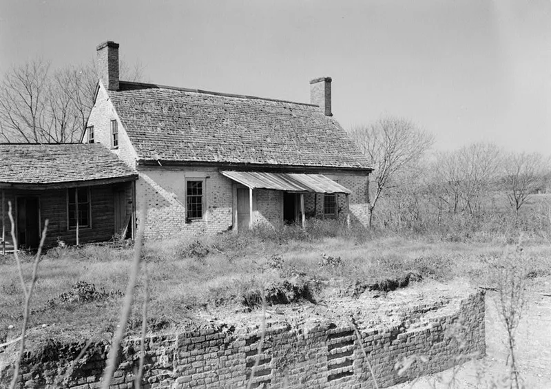
Kingsmill Plantation, about five miles south of Williamsburg, was the home of Colonel Lewis Burwell and was built around 1736. A contemporary description listed a mansion, outhouses, garden and 1,400 acres. The mansion burned or was destroyed about 1843, leaving its foundation and cellar, a terraced garden and two matching brick dependencies, the office and the kitchen. Laid in Flemish bond with glazed headers and gauged brick arches, they are among the earliest brick dependencies in Virginia and are rare survivors of buildings set in front of a mansion to frame a forecourt. The site also includes at least ten outbuilding sites and Burwell's Landing on the James River, where Burwell worked as naval officer. In November 1775 American riflemen skirmished there with British vessels, and earthen forts built afterward fell to the British in 1781. A 1782 map and a test excavation of a well point to strong archaeological potential.
Significance in brief: The two brick dependencies are among the earliest in Virginia and are rare survivors of dependencies placed in front of the mansion to define a forecourt. An accurate 1782 map makes the site important archaeologically, since a largely undisturbed early eighteenth century plantation complex could be located and studied. Burwell's Landing was an economic hub and the site of an early Revolutionary War skirmish in 1775.
Machine-generated summary. This summary was generated by a language model from the official nomination document and has not been reviewed line by line by an editor. It may contain errors. Check the source document before relying on any detail. Source: nomination document (PDF) · National Archives catalog entry. NRHP reference 72001401, listed April 26, 1972. Summary generated October 2026 (model claude-sonnet-5-5, prompt v1.0-2026-10-29, confidence medium).
Key facts
| Address | 5 mi. S of Williamsburg, Williamsburg |
|---|---|
| County | James City County |
| Listed | April 26, 1972 |
| Reference number | 72001401 |
| Resource type | District |
| Period of significance | 18th Century |
| Areas of significance | Historic - Non-Aboriginal, Architecture |
| Level of significance | State |
| Status (as stated in the nomination) | Condition is marked deteriorated and altered. The mansion was destroyed about 1843, but the two dependencies are described as basically structurally sound with tin roofs. |
| Acreage | 135 |
| Coordinates | 37.22713, -76.67919 (NPS GIS) |
What listing means for this property
This is a historic district. Buildings within its boundary are either contributing (they add to the district's significance) or non-contributing. Owners of contributing income-producing buildings can claim the 20% federal rehabilitation tax credit; homeowners should look at state credits. National Register districts impose no design review by themselves; a local historic district ordinance, if one exists, does (the difference explained).
General information, not legal or tax advice. Rules change; confirm with your State Historic Preservation Office or a qualified adviser.
Sources and further reading
- National Park Service, National Register of Historic Places database (snapshot May 2026), reference 72001401.
- Nomination form (PDF, National Archives) — catalog entry
- Wikipedia article (used for cross-checking only; text not reproduced here)
- Wikidata Q6413365
- This listing as JSON
Last updated October 2026. Found an error? See the editorial policy for how to report it.