Glendale National Cemetery
Also known as: VDHR File No. 43-753
Why it's listed
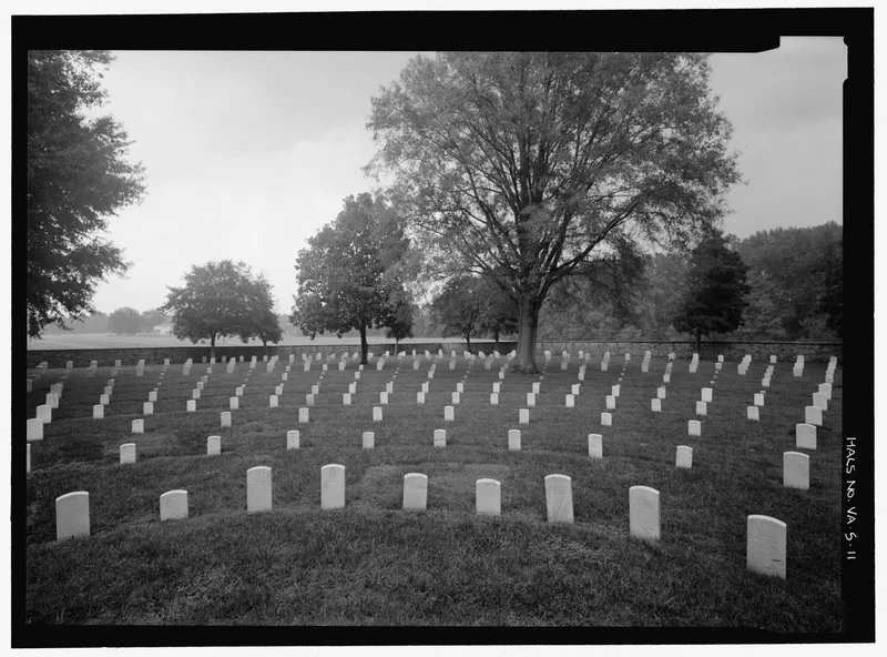
Glendale National Cemetery occupies 2.1 acres on State Route 156 in Henrico County, southeast of Richmond. Established on July 14, 1866, it lies near the ground where Union and Confederate forces fought at Frayser's Farm (Glendale) on June 30, 1862, and at Malvern Hill the next day, during the Seven Days' Campaign. The grounds were laid out by Lt. Colonel John Moore in the shape of a wagon wheel around a central flagpole, and a rubble stone wall built in 1875 encloses them. A Second Empire lodge from 1874, designed by Quartermaster General Montgomery C. Meigs, has a mansard roof of patterned slate with the letters U.S. in lighter slate. Other features include a 1936 brick utility building, a gasoline storage building, entry gates and a monument made from a cast-iron seacoast artillery tube. By August 1995 the cemetery held about 2,000 casketed and 15 cremated remains. It was listed for its Civil War association and the lodge's distinctive design.
Significance in brief: The cemetery is significant under Criterion A for its association with the Civil War, lying in the area of burials from the Seven Days' Campaign of 1862, including the Battles of Frayser's Farm (Glendale) and Malvern Hill. It is significant under Criterion C because its lodge is a prototypical design by Quartermaster General Montgomery C. Meigs.
Machine-generated summary. This summary was generated by a language model from the official nomination document and has not been reviewed line by line by an editor. It may contain errors. Check the source document before relying on any detail. Source: nomination document (PDF) · National Archives catalog entry. NRHP reference 96000026, listed February 26, 1996. Summary generated October 2026 (model claude-sonnet-5-5, prompt v1.0-2026-10-29, confidence high).
Key facts
| Address | Jct of VA 156 and VA 600, 1 mi. S, Providence Forge |
|---|---|
| County | Henrico County |
| Listed | February 26, 1996 |
| Reference number | 96000026 |
| Resource type | Site |
| Period of significance | 1866-1936 |
| Architect / builder | Meigs, Montgomery C. |
| Architectural style | Late Victorian: Second Empire |
| Criteria |
|
| Areas of significance | Military, Architecture |
| Level of significance | National |
| Status (as stated in the nomination) | Closed to new casketed interments on January 19, 1970; interments in occupied graves and of cremated remains continue, with 20 cremation sites available as of August 31, 1995. |
| Acreage | 6.6 |
| Coordinates | 37.43591, -77.23443 (NPS GIS) |
What listing means for this property
Sites (archaeological sites, battlefields, landscapes) are often listed with a restricted address to protect them from looting or disturbance. Listing is honorary for private owners; federal undertakings on or near the site go through Section 106 review, and state laws may protect burials and artefacts regardless of listing.
General information, not legal or tax advice. Rules change; confirm with your State Historic Preservation Office or a qualified adviser.
Sources and further reading
- National Park Service, National Register of Historic Places database (snapshot May 2026), reference 96000026.
- Nomination form (PDF, National Archives) — catalog entry
- Wikipedia article (used for cross-checking only; text not reproduced here)
- Wikidata Q5568375
- This listing as JSON
Last updated October 2026. Found an error? See the editorial policy for how to report it.