Ruffin, Edmund, Plantation
Also known as: Marlbourne

Why it's listed
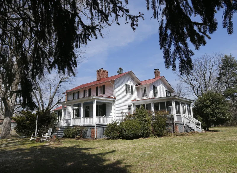
Marlbourne is a plantation in Hanover County, Virginia, about 17 miles northeast of Richmond, where Edmund Ruffin lived from 1843 until 1855. The white frame, two-story house looks over broad lowlands and has two-story front porch, a rear porch, and one-story wings, the east wing added in the 20th century. Only a dairy shed and a smokehouse remain of the original outbuildings. The surrounding fields still show traces of the marl pits and irrigation sites Ruffin used in his experiments. Ruffin helped revive worn-out Virginia soils by applying calcareous earths, wrote An Essay on Calcareous Manures, published the Farmer's Register, and became the first president of the Virginia State Agricultural Society. During his years here he also wrote pamphlets defending slavery and secession. He is buried in the family graveyard on the property. The nominated area follows the lands Ruffin owned between 1843 and 1855 and covers about 1,200 acres.
Significance in brief: The nomination argues that Marlbourne was the home of Edmund Ruffin (1794-1865) and the site of many of his pioneering agricultural experiments. Ruffin restored soil fertility with calcareous earths (marl), and his writings and journal influenced Southern farming. He was also a leading defender of slavery and secession.
Machine-generated summary. This summary was generated by a language model from the official nomination document and has not been reviewed line by line by an editor. It may contain errors. Check the source document before relying on any detail. Source: nomination document (PDF) · National Archives catalog entry. NRHP reference 66000837, listed October 15, 1966. Summary generated October 2026 (model claude-sonnet-5-5, prompt v1.0-2026-10-29, confidence medium).
Key facts
| Address | 11 mi. NE of Richmond on U.S. 360, Richmond |
|---|---|
| County | Hanover County |
| Listed | October 15, 1966 |
| Reference number | 66000837 |
| Resource type | District |
| Period of significance | 1843-1855 |
| Areas of significance | Politics/Government, Agriculture |
| Level of significance | National |
| National Historic Landmark | Yes, designated July 19, 1964 |
| Status (as stated in the nomination) | Described as in fair condition, altered, and structurally sound but in serious need of surface repairs; occupied as a private residence and used for agriculture. |
| Acreage | 1200 |
| Coordinates | 37.66460, -77.22003 (NPS GIS) |
What listing means for this property
This is a historic district. Buildings within its boundary are either contributing (they add to the district's significance) or non-contributing. Owners of contributing income-producing buildings can claim the 20% federal rehabilitation tax credit; homeowners should look at state credits. National Register districts impose no design review by themselves; a local historic district ordinance, if one exists, does (the difference explained).
General information, not legal or tax advice. Rules change; confirm with your State Historic Preservation Office or a qualified adviser.
Sources and further reading
- National Park Service, National Register of Historic Places database (snapshot May 2026), reference 66000837.
- Nomination form (PDF, National Archives) — catalog entry
- Wikipedia article (used for cross-checking only; text not reproduced here)
- Wikidata Q5339801
- This listing as JSON
Last updated October 2026. Found an error? See the editorial policy for how to report it.