Fredericksburg and Spotsylvania County Battlefields Memorial National Military Park

Why it's listed
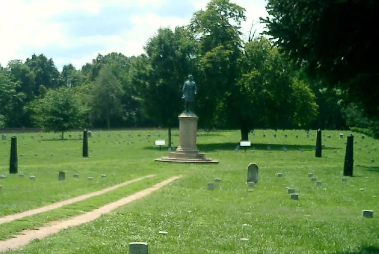
Four major Civil War battles were fought in the countryside around Fredericksburg, Virginia, midway between the rival capitals of Washington and Richmond. This national military park and cemetery covers about 4,601 acres and preserves parts of the Fredericksburg, Chancellorsville, Wilderness and Spotsylvania battlefields. Surviving features include roughly 35 sets of earthworks totaling 37 miles, a 50-yard remnant of the Stone Wall at the Sunken Road, and shallow trenches at the Bloody Angle. Standing buildings include Salem Church, built in 1844 and still scarred by bullets and shells, and Chatham, a Georgian mansion of the 1760s used as a Union headquarters and hospital. The national cemetery holds nearly 16,000 soldiers. A detached site at Guinea Station contains the Jackson Shrine, where General T. J. Jackson died in 1863. Many other houses and the Catharine Furnace survive only as ruins or sites.
Significance in brief: The countryside between Washington and Richmond saw the battles of Fredericksburg, Chancellorsville, the Wilderness and Spotsylvania Court House, with more than 100,000 casualties within a 17-mile radius. The park also holds the house where Confederate General Jackson died on May 10, 1863. Surviving earthworks, the Stone Wall, ruins and houses mark these campaigns.
Machine-generated summary. This summary was generated by a language model from the official nomination document and has not been reviewed line by line by an editor. It may contain errors. Check the source document before relying on any detail. Source: nomination document (PDF) · National Archives catalog entry. NRHP reference 66000046, listed October 15, 1966. Summary generated October 2026 (model claude-sonnet-5-5, prompt v1.0-2026-10-29, confidence medium).
Key facts
| Address | Address restricted by the NPS (common for archaeological sites and some private homes) |
|---|---|
| County | Fredericksburg |
| Listed | October 15, 1966 |
| Reference number | 66000046 |
| Resource type | Building |
| Period of significance | December 1862 - May 1864 |
| Architectural style | Georgian (for Chatham) |
| Areas of significance | Military, Architecture |
| Level of significance | National |
| Status (as stated in the nomination) | Park lands are in good condition but altered. Roads and modern development surround and cross the battlefields. Several structures are ruins or sites with no visible remains. |
| Acreage | 4601.1 |
| Coordinates | 38.24796, -77.68079 (NPS GIS) |
What listing means for this property
For a publicly owned building or structure, listing mainly matters when federal funds, permits or licences are involved: projects then go through Section 106 review so effects on the property are considered. Listing also strengthens applications for preservation grants and, for leased income-producing uses, can enable the federal rehabilitation tax credit.
General information, not legal or tax advice. Rules change; confirm with your State Historic Preservation Office or a qualified adviser.
Sources and further reading
- National Park Service, National Register of Historic Places database (snapshot May 2026), reference 66000046.
- Nomination form (PDF, National Archives) — catalog entry
- Wikipedia article (used for cross-checking only; text not reproduced here)
- Wikidata Q181893
- This listing as JSON
Last updated October 2026. Found an error? See the editorial policy for how to report it.